 December Map Displays: Happy Birthday, Indiana
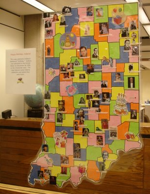
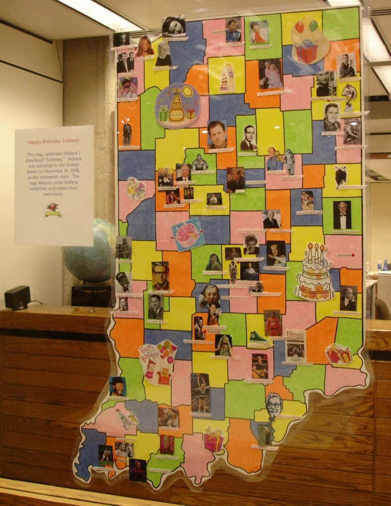
Hannah Hilleson, student-assistant in the Geospatial Center & Map Collection, created this map showing famous people born in Indiana. The map commemorates Indiana's "birthday" (admission to the Union) in December 1816. The map reveals the birthplaces of famous Hoosiers in many fields of public life. This map marks Hannah's last project for the GCMC due to her December graduation. Hannah has worked in the GCMC since the fall of 2002.
The December "Map of the Month" is the National Geographic sixtieth anniversary edition map of Pearl Harbor.
Visit the GCMC on the second floor of Bracken Library to view these displays and many others.
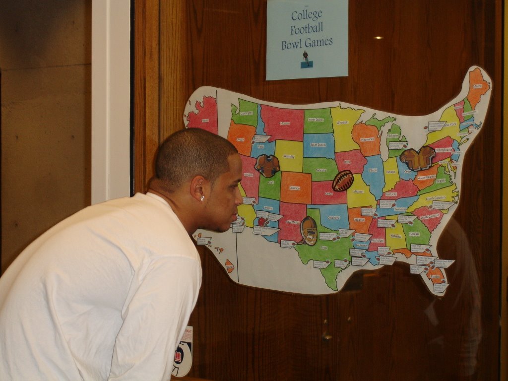
 Going Bowling: College Football Bowl Games on the Map
The college football bowl season kicked off this week with the Poinsettia Bowl in San Diego, California, on December 19. A map showing the locations of the 32 major bowl games is on display in the window of the Geospatial Center & Map Collection on the second floor of Bracken Library.
Most of the bowl games are located in the southern part of the United States, but Toronto, Detroit, and Boise are also sites for the games. Florida hosts five bowls, with California, Texas, and Louisiana hosting four. The National Championship game will be in Glendale, Arizona, on January 8.
Visit the GCMC to view this map and other map displays over the holiday break. Please contact the Center with questions about this map or any other information.
 December Geospatial Center & Map Collection Hours and Closings
The GCMC will operate with regular hours during finals week and the semester break--Monday through Friday 8:00 A.M. to 5:00 P.M. The Center will close at 3:00 P.M. on Friday, December 22 and Friday, December 29. The GCMC will be closed on December 25, 26, and January 1. Please contact the GCMC staff at (765) 285-1097 with any questions.
 Vote for the New Seven Wonders of the World
Swiss adventurer Bernard Weber began a campaign in 1999 asking for nominations for the "New Seven Wonders of the World." The Egyptian pyramids are the only surviving structures from the original list of seven. Gone are the Statue of Zeus at Olympia, the Temple of Artemis as Ephesus, the Hanging Gardens of Babylon, the Mausoleum of Halicarnassus, the Colossus of Rhodes, and the Pharos lighthouse off Alexandria.
Candidates for the new list have been narrowed down to 21. The public can vote for the choices on the Internet at www.new7wonders.com. The Statue of Liberty is the only architectural marvel on the list in the United States. The other candidates are the Acropolis in Greece, Alhambra in Spain, Christ the Redeemer Statue in Brazil, the Colosseum in Italy, Easter Island of Chile', the Eiffel Tower in France, the Great Wall of China, Haghia Sofia in Turkey, Kiyomizu Temple in Japan, the Kremlin and St. Basil's Cathedral in Russia, Machu Picchu in Peru, Neuschwanstein Castle in Germany, Petra in Jordan, the Pyramid at Chichen Itza of Mexico, the Pyramids of Giza in Egypt, Stonehenge in Great Britain, the Sydney Opera House in Australia, the Taj Mahal in India, and the two mosques of Timbuktu, Mali.
The Geospatial Center & Map Collection has a collection of architectural pictorial guide maps that feature some of these great marvels of engineering and design. The Great People of the Past maps from National Geographic also include maps of the grounds of the Acropolis and other ancient formations. A display featuring information about the new candidates is currently featured in the windows of the GCMC.
 GCMC November 2006 "Map of the Month"
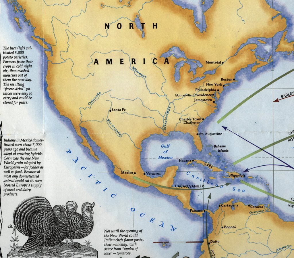
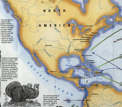
The "Map of the Month" for November 2006 in the Geospatial Center & Map Collection was a map titled Spain in the Americas, published by the National Geographic Society in 1992. The verso of the map "The Grand Exchange" was displayed due to its relationship to the Thanksgiving holiday. This side of the map shows the exchange of foods and other products between the Americas and Africa and Europe. The map mentions that turkeys were domesticated by the Aztecs and later became popular in Europe. The Pilgrims actually brought turkeys to America with them--only to find them living in the wilderness of New England. And "out of the myriad crops of the Americas, two--corn and potatoes--spread so widely that they became staples of human survival."
This map is available for checkout at the Geospatial Center & Map Collection.
 November 2006 in the GCMC: What is GIS? Where is Congerville? and World War II
Students in Journalism 102 learned about what GIS is and how it is used in journalism and the media during a class presented by Angela Gibson from the Geospatial Center & Map Collection on November 13. Students in the Education Library 380/580 class learned about different types of maps and atlases, software, websites, and other resources during a class in the GCMC presented by Melissa Gentry on November 21. And Biology students learned about nautical charts in a special class project using maps from the GCMC.
Students from Industry and Technology: Construction Technology classes were provided digital aerial maps of campus for a class surveying project. A group of architecture students needed digital footprints of buildings in downtown Muncie. Another patron asked to view some of the aerial photgraphy of Indiana available in the GCMC to assess the implications of the proposed Indiana toll road in the local community.
Students from classes in geology, elementary education, geography travel and tourism, architecture, landscape architecture, historic preservation, communications, English, and music borrowed maps and atlases for various projects. One student was teaching elementary students about map projections, so she borrowed the Upside Down Map of the World to show a different perspective about making maps.
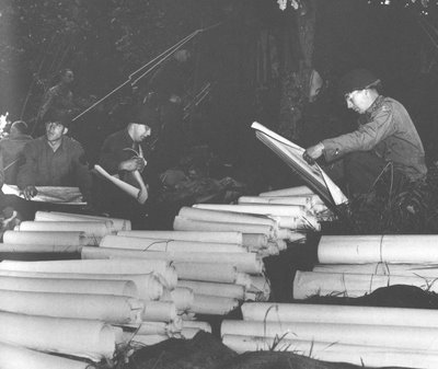
A World War II veteran used the services of the GCMC in November. The veteran was trying to find a map of the city of Reims in France, where he was stationed during the war. A copy of one of the maps was printed on the Center's large-format plotter. Another patron was planning an ambitious canoe trip and borrowed maps of Indiana rivers. And one researcher visited the Center trying to locate the village of Congerville in Delaware County--once the site of a professional football team, the Flyers.
Visit the GCMC Monday through Friday for GIS, maps, atlases, or to use the plotter printer. Contact the staff of the GCMC to schedule instructional sessions in the classroom or in the Center.
(The above photograph shows soldiers in World War II with a stockpile of maps. The photograph is from the Collection of Dennis Giangreco from the U.S. Army Atlas of the European Theater in World War II created by the U.S. Army Center of Military History and is available in the Atlas Collection of Bracken Library).

 December Map Displays: Happy Birthday, Indiana