Thursday, September 28, 2006

National Geographic-Roper Survey Results


Good News and Bad News from National Geographic

The 2006 National Geographic-Roper Survey of Geographic Literacy delivered some bad news about the basic geographic skills of young Americans. Over 500 "young Americans" aged 18 to 24 from the continental United States were interviewed to test geographic knowledge. Respondents answered about half (54 percent) of all survey questions correctly. Geographic knowledge in today's world is critical as the future for young Americans grows increasingly global. World events dictate key understanding of geographic concepts and skills. The majority of young Americans lacked these skills and an understanding of the world today. Even recent news events, wars, and disasters didn't increase geographic awareness:

  • 88% could not find Afghanistan on a map of Asia.
  • Only 37% of those surveyed could find Iraq or Saudi Arabia on a map of the Middle East, and 75% couldn't find Israel or Iran.
  • 75% of the young Americans did not know that a majority of Indonesia's population is Muslim.
  • 54% did not know that the Sudan is in Africa.
  • 70% could not find North Korea on a map.
  • 33% could not find Louisiana on a map of the United States.
  • Half of the young Americans could not find the state of New York on a map.

The survey also revealed that many young Americans' awareness about the world in which they live was limited. Six in ten don't speak a foreign language fluently, and three-fourths believe English is the most commonly spoken native language in the world, rather than Mandarin Chinese. And only 22% of the young Americans have a passport.

There was some good news in the report: Many young Americans did have map reading and navigation skills, and half actually answered that map reading skills are "absolutely necessary." Also the number of young Americans who read current events on Internet news sites has more than doubled in the last four years. This is hopeful because respondents who used the Internet to read the news actually performed better on the geography test.

National Geographic has launched a program and blog called My Wonderful World to help increase the geographic literacy and awareness. This program is "a campaign to increase global learning in school, at home, and in the community." The site offers ideas and activities for anyone interested in geography and is located at http://mywonderfulworld.typepad.com/my_wonderful_world_blog/

National Geographic also created a huge supersite called People and Places that will help anyone learn more about the world. The site includes photographs, maps, and information about every country in the world and is located at http://www3.nationalgeographic.com/places/

Test your geographic knowledge at http://www.nationalgeographic.com/roper2006/

Please contact or visit the GCMC for more ideas about improving the geographic literacy of the young Americans in your life.

Wednesday, September 27, 2006

Sanborn Fire Insurance Maps Recently Added to GCMC


Where's the Fire?
Sanborn Fire Insurance Maps at University Libraries


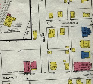
Sanborn fire insurance maps date back to 1867 and were originally produced for the purpose of assessing risk of fire and the cost of insurance. These maps are highly detailed color maps that record individual building "footprints" and information about streets, businesses, residences, and utilities. Sanborn maps include construction details such as building materials, height and number of stories of buildings, location of doors, windows, fuel storage tanks, and chimneys. The functions of the buildings are provided as well as street names, street and sidewalk width, property boundaries, and house and block numbers.

Sanborn maps are valuable historical tools and are used by researchers in such fields as history, genealogy, architecture, historic preservation, and sociology. The maps offer lessons about the growth and development of the neighborhood.

The Geospatial Center & Map Collection recently added sets of Sanborn fire insurance maps for St. Louis, Missouri, and Boston, Massachusetts. Paper Sanborn maps of the following Indiana cities are also available in the GCMC:

  • Anderson, Madison County, 1895
  • Batesville, Ripley County, 1919
  • Bedford, Lawrence County, 1922
  • Bluffton, Wells County, 1919
  • Camden, Carroll County, 1899
  • Dugger, Sullivan County, 1915
  • Farmland, Randolph County, 1911
  • Hartford City, Blackford County, 1920
  • Hobart, Lake County, 1922
  • Hymera, Sullivan County, 1910
  • Kendallville, Noble County, 1922
  • Loogootee, Martin County, 1920
  • Mitchell, Lawrence County, 1918
  • Moores Hill, Dearborn County, 1918
  • Noblesville, Hamilton County, 1922, 1887, 1892
  • North Vernon, Jennings County, 1927
  • Rising Sun, Ohio County, 1906
  • Russiaville, Howard County, 1913
  • Van Buren, Grant County, 1911
  • Vernon, Jennings County, 1911
  • Wabash, Wabash County, 1920
  • Winamac, Pulaski County, 1911
  • Wolcott, White County, 1919

Sanborn maps of Muncie, Indiana, are located in the Archives & Special Collections Research Center. A copy of Sanborn Manhattan Land Book of the City of New York, 1995 and Fire Insurance Maps: Their History and Applications can be found in the Atlas Collection on the second floor of Bracken Library. Sanborn maps from other Indiana cities, as well as Ohio, Kentucky, and Tennessee are located in Microforms. Microforms also has a copy of Fire Insurance Maps from the Sanborn Map Company Archives.

Please contact the GCMC for more information about using Sanborn fire insurance maps in your research project.

Tuesday, September 19, 2006

Going to Class with GIS


GIS in the Classroom
What can the GCMC GIS lab do for students, professors and teachers?

1) Assist in planning GIS-related assignments for individual classes.

2) Help teachers find and use reliable GIS data for an assignment or research project.

3) Assist students with GIS assignments and research.

4) Provide tutorials, both online and in-house, for self-teaching of the GIS software.

5) Provide computer space on a library server to save projects or help users set up an ilocker account for saving projects.

6) Provide access to a large format plotter for printing out maps and posters for classes, presentations, and conferences.

7) Give presentations to classes on what GIS is and how it can be used in their field of study.

Contact Angela Gibson, GIS Specialist, for more information. Check out the GCMC website for links to downloadable data and online applications, examples of how GIS is being used in different fields of study, and links to online self-guided tutorials: www.bsu.edu/library/collections/gcmc

Friday, September 15, 2006

GIS Newsletter

GIS Council Allows for Networking

Students and others interested in the GIS industry may wish to consider membership in the Indiana Geographic Information Council (IGIC). The Council is a nonprofit organization whose mission is to lead the effective application of geographic informaiton in Indiana. The Council is an organization of GIS users, professionals, and educators. Membership in the Council provides GIS tools and resources, outreach and educational events, networking, and data information and access. The Council hosts an annual conference in Indianapolis in the spring with many workshops and meetings. Members also receive a monthly newsletter that proves to be an invaluable resource.

The Council recently provided information in its newsletter and on its website about the IndianaMap project. The Council helped to sponsor the IndianaMap project and webpage, which is located at www.indianamap.org . The site includes layers with aerial photography, elevations, boundaries, waters, and roads--all available free to the public.

The cost for membership dues for students is $15. The Indiana Geographic Information Council website is located at www.in.gov/igic/

Thursday, September 14, 2006

Going to Class with Maps and Atlases

Using Maps and Atlases in the Classroom

Professors and teachers interested in using special maps, map sets, or atlases to enhance their lessons should contact or visit the GCMC for information. Staff of the GCMC will even help create learning tools and lessons to use inside or outside the Center. This summer elementary students visited the GCMC and completed a scavenger hunt about maps created by the staff. And a class of geography students reviewed maps of Las Vegas and other cities to learn about development. The GCMC can provide materials for a number of disciplines and topics of study:

Anthropology, Archaeology, Sociology:
Ancient Egypt maps with features
Cuzco region of Peru (Machu Picchu) maps
Atlas for Anthropology
Archaeology of Jerusalem (map)
Archaeology and Indians of South America (map)
The State of the World on Monday, January 1st, 1000 A.D. (religions, staple foods, construction) (map)

Architecture and Planning:
Pictorial maps with architecture guides of world cities
Bird’s Eye View maps of American cities
Sanborn fire insurance maps
USGS topographic maps for the United States
World topographic maps
The Phaidon Atlas of Contemporary World Architecture
Bird's Eye Views : Historic Lithographs of North American Cities
(atlas)
Thousands of atlases and street maps of world cities

Art and Music:
Atlas of Western Art History
Harlem Renaissance Map: One Hundred Years of History, Art, and Culture
(map)
Atlas of Art
Hitting the Road: The Art of the American Road Map
(atlas)

Education:
National Geographic topics/thematic maps with features (explorers, environment, soccer, animals)
Atlas of American Higher Education
Indian Country: North American Indian Cultures, a Legacy of Language and Inspired Ideas (map)
Growing Up in America: An Atlas of Youth in the USA
Children’s Atlas of the United States


English and Literature:
Shakespeare’s Britain (map)
Literary Map of Indiana (map)
American Folklore and Legends (map)
Medieval England (map)
Land of the Limberlost (map)
Atlas of World Cultures : a Geographical Guide to Ethnographic Literature
Atlas of Fantasy
(includes maps of fictional locations from Sherlock Holmes, Princess Bride, and many others)

Languages and Classics:
Large collection of atlases in various languages (German, Polish, French, Japanese, Arabic)
Atlas of the World’s Languages
A Word Geography of England
(atlas)
Tartan Map
Clan Map of Scotland
Spain in the Americas
(map with features)

Geography:
Travel and tourism, AAA guides
Tuscany Travel Reference Map
World Travel Adventure Map
Traveler’s Atlas: A Global Guide to the Places You Must See in a Lifetime

Touring Map of Israel
Travel Reference Map of the Amazon Basin
Gazetteers, geographical dictionaries, and other resources

History:
Map of the Reservations at Fort Wayne, Indiana, Surveyed 1803 (map)
D-Day Normandy Landing Map (plus war-era map of Normandy)
Lewis and Clark Expedition (map)
World War I- and World War II-era maps (world, Germany, France)
A Map of the Travels of George Washington
Pearl Harbor/Pacific Theater Reference Map
Historical Atlas of the Celtic World
Underground Railroad Routes through Indiana
(map—plus similar map of U.S.)
Civil War Battle Sites (map)
Large collection of historical atlases
Historical Atlas of Ancient Mesopotamia

Military Science:
Civil War maps and atlases
Revolutionary War maps and atlases
Iraq Planning Map
Major Insurgent Groups in Afghanistan 1985 (map)
CIA maps of world countries
U.S. Army Atlas of the European Theater in World War II
The War in the Persian Gulf
(map)

Natural Resources and Environmental Management:
Earth at Night (map)
Australia Under Siege (map)
Soil maps, land use maps, vegetation zones, wetlands, flood maps
Species in Africa (map)
Oil and Gas Product Pipelines in Indiana (map)
One Planet, Many People : Atlas of Our Changing Environment
Ecoregions of Indiana and Ohio
(map)

Nursing, Physiology:
Atlas of AIDS
Atlas of American Women: Health, Disease, Pregnancy
Atlas of Disease Distributions

State of the World Atlas: Nutrition, Health Risks
AIDS in Latin America and the Caribbean (map)

Physical Education and Sports:
Baseball Travel Map
Bike Trails Maps from various states
Soccer Unites the World (map with features)
Atlas of American Sport
USA Today Golf Atlas


Political Science:
Presidential Elections, 1789-2000 (map with statistics)
Congressional Districts (map)
Atlas of American Politics
Kosovo Atlas and 2001 Election Day Reference Guide
Student Atlas of World Politics

South Germany, National Assembly election results, 1919

Religious Studies:
Atlas of Man and Religion
Historical Atlas of the Crusades
Historical Atlas of the Jewish People
Map showing distribution of religions in the world
Map of the Holy Land
Lands of the Bible Today
(map)
Historical Atlas of Religion in America
Mormon Pioneer National Historic Trail
(map)
Historical Atlas of Islam

Science:
Map of the Moon
Planetary maps
Galapagos Islands map
Titanic Reference Map (showing steamship routes, disaster site, other shipwreck sites, ocean currents)
Nautical and aeronautical charts of the world
Atlas of the Flora of the Great Plains
Irrigation Atlas of India
Hawaii’s Volcanoes Revealed
(map)
This Dynamic Planet: World Map of Volcanoes, Earthquakes, Impact Craters, and Plate Tectonics (map)
Atlas of the Ocean
Location of Dinosaur Fossils
(map)

Women’s Studies:
Historical Atlas of Women in America
The State of Women in the World (Work, Education, Health, Personal Freedom)
(atlas)

Other Interesting Maps and Atlases:
Atlas of Treasure Maps
Upside Down World Map
Route 66 Map
Sudan’s Darfur Region
Ball State University campus maps (historic to present)
Historical atlases for genealogy research
USGS topographic maps
Aerial photographs of Delaware, Grant, Madison, Randolph counties
8 ½ x 11” CIA maps of countries of the world
Aeronautical and nautical charts
Atlas of Fantasy (includes maps of fictional locations)

Tuesday, September 12, 2006

Genealogy Research in the GCMC

Finding Your Roots in the Geospatial Center & Map Collection

The Geospatial Center & Map Collection, along with many other areas of University Libraries, is an excellent resource center for the genealogist. The GCMC has many different materials for those researching their family history. Sanborn Fire Insurance maps show depictions of residential sections of various Indiana towns, and the Center just added Sanborn maps for St. Louis and Boston to the Collection. The Illustrated Historical Atlas of the State of Indiana, 1876, provides information not only about different towns throughout Indiana, but also some of the residents of the towns. Genealogists can also review historic county atlases and plat books from various Indiana counties dating back to 1874. The GCMC also has historic resources from other areas around the United States.

Jane Beekman, local genealogist and author, often uses the GCMC to complete her research. Mrs. Beekman has researched areas in Oklahoma, Virginia, and most recently France and Germany. Mrs. Beekman and the GCMC were recently featured in the Ball State Alumnus magazine in an article about genealogy, "Tracing Family Roots" by Leslie Benson. The article can be viewed at the following website:
www.bsu.edu/alumni/january2006/beyondtheclass/

Please contact the GCMC at (765) 285-1097 for more information about genealogy research using maps and atlases.


Thursday, September 07, 2006

August 2006 Map Displays


In the Window
August 2006 GCMC Map Displays

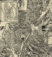
The "Map of the Month" was actually two maps of the Panama Canal to mark its August 1914 opening. The Panama Canal still ranks as one of the greatest engineering achievements in the world. With its completion, ships no longer had to travel around South America, saving a distance of more than 13,000 miles. The map featured here is a bird's-eye view map that was drawn by Charles Owens of the Los Angeles Times in 1925. Owens was the first artist to fly over the Canal Zone. The other "Map of the Month" was a map of the Canal that was actually a supplement in the October 1905 National Geographic magazine.

Also featured in the window of the GCMC are maps showing the location of each of the opponents of Ball State University's football team. Another map created by the GCMC staff features the top ten study-abroad programs available through Ball State University. (The London Centre is number one).

Please visit the Geospatial Center & Map Collection on the second floor of Bracken Library to view the other maps displayed in the window. A map commemorating the anniversary of September 11 is currently featured.

Wednesday, September 06, 2006

August 2006 GCMC Events


August 2006 in the GCMC: Football, the Fair, and "Final Victory"

August usually means back-to-school activities in the Geospatial Center & Map Collection, but this year some different projects were completed just before the end of the summer break:

Ball State University assistant football coach Eddie Faulkner requested a map displaying the hometowns of each of the running backs on the team. The map was created with GIS software and included photographs of each player next to the hometown. The map is currently displayed in the football office at the stadium.

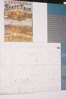
Historic maps borrowed from the GCMC were displayed at the "Ball State Backyard" at the Indiana State Fair. The GCMC was credited for providing the maps along with maps from the Indiana Historical Society and the State Archives.

Chris Reidy, Graphics Production Coordinator at the Ball State University Teleplex, borrowed a map from the GCMC for use in a documentary he is producing for WIPB and the History Department. The documentary is titled "Hitler's Final Victory," and the map shows the location of a battle that took place during World War II in the Ukraine. The GCMC is credited in the film.

A new set of Sanborn insurance maps of Boston and St. Louis were added to the GCMC collection in August. These maps are available as reference materials in the Center.

Students completing a summer project for Landscape Architecture borrowed topographic maps of Mexico. The group of students traveled to Mexico this summer for their class.

Architecture students borrowed maps from the Center in preparation for a unique project. The students are working on a monument site for the National Day of Mourning.

Students at the Australia Center will be using a set of topographic maps and aerial photography borrowed from the Center for their classwork in Australia. The maps were safely transported to Australia in August.

Many other students used the GIS, maps, atlases, and other resources of the GCMC during August. The areas of study were diverse: biology, marketing, English, geography, and political science.

The school year is just beginning, so visit the GCMC for assistance with class projects or to print a poster for a presentation.


Tuesday, September 05, 2006

Upcoming Workshops in the GCMC

Workshops in the GCMC

University Libraries Technology Training is sponsoring workshops hosted in the GCMC this month. Please visit www.bsu.edu/techtrain/ to sign up for any of the classes:

Introduction to GIS and Map Resources: This session introduces attendees to the geospatial resources available at Bracken Library. Explore the Map Collection and get ideas on how to use maps in your course assignments. In the GIS lab, explore the leading GIS software, online GIS tutorials, datasets, online applications, and in-house digital GIS data. This session is in presentation format with one-on-one assistance from professionals. This workshop will be held in the GCMC on September 6 at 2:00 P.M. and September 19 at 1:00 P.M.

GIS Data: How to Find Reliable Data on the Web: Do you need GIS data for a project that you're working on and don't know where to find it? Are you limited on your funds and need free data? How do you know if the data you're downloading is spatially accurate or up-to-date? Learn some simple rules for finding the most accurate data for your needs and for reading and interpreting the metadata that comes with it. This workshop will be held in the GCMC on September 7 at 9:30 A.M. and September 20 at 2:00 P.M.

Can't attend at those times? Please contact the Center at 765-285-1097 for personal assistance with your projects or course planning.