Friday, December 28, 2007

Color Printing at Ball State University Libraries

Color Printing at Ball State University Libraries

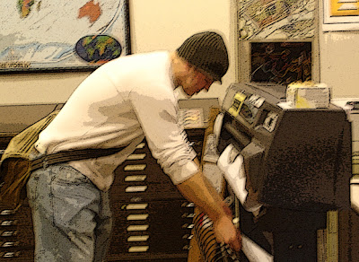
The Geospatial Resources & Map Collection has a large-format plotter available for anyone with a Ball State University account. The paper is 36 inches wide and prints copies as long as 108 inches. The charge for posters is $8 for the first 36 inches, $10 for prints from 37 to 72 inches, and $12 for prints from 73 to 108 inches. The charges are sent through the Bursar’s Office billing system.

Smaller color copies up to 11 by 17 inches can also be made at Bracken Library for 25 cents per page. From any computer in University Libraries, simply open the file menu and select “Print.” Use the drop-down box to select the color printer on 1 East or 1 West. Click either “OK’ or “Print” depending on the program. Type a name for the print job or select the option to use the file name and click “OK.” Pre-pay 25 cents per page at the selected printer, either with a copy card or with cash. Touch the “Mailbox” tab on the printer display. Touch the first box “BSU,” then select your print job from the list. Touch the “Print” button and “Start Print.”

Wireless laptop printing is also available in Bracken Library. To access this service, go to http://www.bsu.edu/libraries/laptopprint. Print jobs may be sent from the laptop to the Periodical/Reserve area of Bracken Library, the Architecture Library, Educational Resources Collections in Bracken Library, the Science-Health Science Library, and the first floor lobby of Bracken Library.

Maps in the News: Pakistan

Maps in the News: Pakistan

Pakistan is a country in turmoil. Benazir Bhutto, the Pakistani opposition leader and former prime minister, was assassinated Thursday as she left a political rally in Rawalpindi, Pakistan.

The Geospatial Resources & Map Collection is an excellent resource for information on Pakistan and other countries in the news. A variety of maps of Pakistan are available in the GRMC, including a map showing major ethnic groups, a tourist map of Pakistan, and a tectonic and geological map of Pakistan. The Central Intelligence Agency published a map of the political divisions of Pakistan, and another map shows the area of the border between Pakistan and Afghanistan. National Geographic published a map of Afghanistan and Pakistan, and a set of satellite image maps of Pakistan are also available in the Collection. Maps of cities in Pakistan include Rawalpindi, Islamabad, Lahore, Peshawar, and Karachi. Another map shows the Pashtun territory of Pakistan.

The Atlas Collection includes cultural, historical, and economic atlases of Pakistan. More information can be found about the country in atlases of India, the Middle East, and South Asia.

For more information about these resources, please contact the Geospatial Resources & Map Collection in Bracken Library.

Wednesday, December 26, 2007

Historic Atlas of Indiana Available at University Libraries

Rare Atlas of Indiana in University Libraries

Indiana was admitted to the Union on December 11, 1816, and six decades later the first important historical atlas of the state was published by Baskin, Forster, & Company in Chicago. The Illustrated Historical Atlas of the State of Indiana was created by Alfred T. Andreas in 1876. Copies of this invaluable resource are available as a reference item in the Geospatial Resources & Map Collection and Archives & Special Collections of University Libraries.

The atlas features 462 pages of maps of Indiana counties as they were divided in 1876. Each map includes the county seat, various townships, railroad lines, communities, churches, creeks and rivers, lakes, cemeteries, major landholders, and blacksmiths and other businesses. Colorful illustrations show courthouses and other government buildings, businesses, and private residences.

Maps of congressional, senatorial, and judicial districts of Indiana are included. Maps of the United States featuring various ethnic groups and agricultural production are featured in the front of the book. The atlas also includes thorough county histories, a business directory divided by county, and vital statistics for the United States in the back of the book. This informative atlas serves as a valuable resource for historians, historic preservationists, and genealogists.

For more information about this atlas, please contact the staff of the GRMC or Archives & Special Collections.

Maps of Toronto Available at University Libraries


GRMC Maps of Toronto for International Bowl

Ball State University’s football team will be representing the Mid-American Conference versus Rutgers University of the Big East Conference in the International Bowl in Toronto, Canada. The game will be played at noon on January 5, 2008, in Rogers Centre, formerly the Sky Dome.

Fans of the football team traveling to Toronto may wish to visit the Geospatial Resources & Map Collection to find maps of the city. The GRMC offers a variety of resources for fans traveling to Canada or for those interested in learning more about Toronto’s history.

The Collection includes two-2003 edition street maps of Toronto and the surrounding area, featuring inset maps of the downtown, driving distance charts, and toll and ferry information. An illustrated map of downtown Toronto from 2002 also features a map of the airport and subway system. A map of metropolitan parks of Toronto is available, as well as a port and harbor map of the city.

A great map for travelers is the imap of Toronto (shown above). The imap series of maps are laminated and include a working compass attached to the top of the map. This map displays tourist destinations, shopping centers, restaurants, and sporting venues.

Another map perfect for traveling is the Toronto EasyFinder map. This map is easy to handle and fold and extremely durable. The map features a map of downtown Toronto on one side and greater Toronto on the verso.

For those interested in learning about the history of Toronto, the Collection includes a bird’s-eye view map of Toronto from 1876. The Mapping of Victorian Toronto, Ontario’s History in Maps, and The Concise Historical Atlas of Canada are available in the Atlas Collection.

Maps may be borrowed from the GRMC for two weeks, while atlases check out for 28 days. For more information about these or any other resources, contact the GRMC in University Libraries at 765/285-1097.

Google Maps Street View of Indianapolis


Touring the Streets of Indianapolis with Google Maps

Google Maps has added Indianapolis, Indiana, and seven other cities to its “Street View” service, originally unveiled in June at http://maps.google.com/

Click on the left top tab marked “Street View” and click on the streets outlined in blue to view the new feature for Indianapolis. The service lets users explore 360-degree panoramic views of cityscapes and even some residential streets. The high-resolution photographic views are not live and were actually taken from vehicles driven along public streets within the last year. The images enable street-level tours so users can get a more realistic view of places researched on the maps site.

Holidays in the Geospatial Resources & Map Collection

Holidays in the GRMC

Winter and the season of holidays have officially arrived, and the Geospatial Resources & Map Collection offers a variety of materials for research, learning, and just for fun.

Winter recreation maps are available for Oregon, Maine, New Hampshire, Colorado, Montana, and the Adirondacks. The Collection includes maps of winter trails in national forests, cross country skiing maps, and downhill skiing maps, including resort maps of Aspen and Vail and regional skiing maps of Vermont.

Celebrate the holidays in the GRMC with maps of holidays in Switzerland, Santa Claus, Indiana, and North Pole, Alaska. The Collection includes a variety of maps of Bethlehem, including a bird’s-eye view of the old city and a guide, and numerous maps of the Holy Land.

The Geospatial Resources & Map Collection will be open Monday through Friday from 8:00 A.M. to 5:00 P.M. for the rest of semester break. The GRMC will close at 3:00 P.M. on Monday, December 31, and will be closed on New Year’s Day.

Friday, December 07, 2007

Mapping the Literary World Display at University Libraries


Mapping the Literary World Exhibit in Bracken Library

Mapping the Literary World, a special exhibit featuring maps and atlases related to literature, will be on display from December 3, 2007 through February 28, 2008 in the cases on the east side of the first floor of Bracken Library.

Students and faculty often use maps and atlases for research and learning or in the classroom for studying geography or even history. Maps can also be used for literary purposes. The University Libraries’ Geospatial Resources & Map Collection and the Atlas Collection include many maps and atlases that can be used in the study of English and literature.

Some of the maps on display feature famous authors from various states and countries or the poets and authors popular during a specific era of history like the Harlem Renaissance. Other maps depict the actual settings of popular works of literature like the Shakespeare’s Britain map. Still other maps and atlases display fictional places, like the maps of Narnia, Atlas of Middle Earth, Tolkien’s Beleriand, or Pooh Bear’s Hundred Aker Wood from the Atlas of Fantasy.

The display also features related works of literature and images from Archives & Special Collections.

Commemorative Pearl Harbor Map Available in the Geospatial Resources & Map Collection


Commemorative Map of Pearl Harbor in the Geospatial Resources & Map Collection


The Geospatial Resources & Map Collection includes a 60th anniversary map of the attack on Pearl Harbor from the National Geographic Society. This unique map provides a detailed overview of the events of December 7, 1941, and is available from the GRMC for research or classroom presentations.

The front of the map displays an aerial view of Battleship Row and the Navy Yard three days after the Japanese raid and details the damages to the individual ships with illustrations of squadron insignia in the margins. A bird’s eye-view of Oahu shows the first and second waves of the aircraft attack and paths over the Pacific Ocean of the Japanese strike force. The verso of the map is a reproduction of the Theater of War in the Pacific Ocean map, which was originally a supplement to the February 1942 issue of the National Geographic magazine.

Maps from the GRMC check out for two weeks. The GRMC is open Monday through Friday from 8:00 A.M. to 5:00 P.M.