National Global Warming Event at Ball State University
Ball State University will be hosting Focus the Nation: Global Warming Solutions for America on Thursday, January 31, 2008, from 10:00 to 5:00 in the Student Center. Focus the Nation is a national teach-in engaging millions of students and citizens with political leaders and decision makers about global warming solutions. Faculty, students, and staff put aside “business as usual” for one day to focus on global warming issues.
Some of the topics presented during the day include ecological design, hydrological effects of climate change, the American lifestyle, faith and climate, and technological solutions to climate change. Maps and atlases focusing on climate change and environmental issues from the Geospatial Resources & Map Collection and Atlas Collection will be included in part of the display.
The closing ceremony will include Sue Errington, State Senator, and Doran Moreland, representative from Senator Evan Bayh’s office. The event is endorsed by President Gora and the Council on the Environment and sponsored by Students for a Sustainable Campus and the Center for Energy Research/Education/Service.
Monday, January 28, 2008
National Park Service Unveils New Web Camera
Old Faithful Web Camera Goes Live this Week
The National Park Service this week unveiled a live streaming Web camera of the Old Faithful Geyser in Yellowstone National Park. This live camera replaces the popular previous Web page that updated every 30 seconds. The camera also captures activities at other geysers in the park like Beehive, Giantess, and Lion. Wandering wildlife may also be captured by the camera. The Web camera can be viewed at http://www.nps.gov/yell/photosmultimedia/yellowstonelive.htm
Native American Site on University Libraries' Aerial Photography
Native American Sacred Site on University Libraries’ Aerial Photography
Archaeological researchers from Ball State University have identified a circular ditch near Yorktown, Indiana, as an earthwork of Native American origin according to the Muncie StarPress. The earthen structure was built about 2,000 years ago and measures 230 feet across. The circular ditch is 13 feet wide and three feet deep. The site lies just 150 feet from Indiana State Road 32 (Kilgore Avenue) just west of Nebo Road.
The site, dubbed Yorktown Circle, was probably used as a sacred site for ritual activities. No Native American artifacts have been recovered from the site, but researchers plan to nominate the circle to both the State and National Register of Historic Places.
The Delaware County Office of Geographic Information System (GIS) reported the site to Ball State researchers in 2005 after observing perfect circles on topographic maps and aerial photography.
Aerial photography of Delaware County published in 1941 available in the Geospatial Resources & Map Collection (shown above) clearly shows the site before many of the trees existed around the ditch. A Google Earth image of the current site (below) shows how trees have surrounded the circle.
Aerial photographs of Delaware County from 2005 are also available in the GRMC. Digital images can be accessed and saved or printed using the large-format plotter. The Collection also includes historic aerial photographs from other Indiana counties and several other states.
For more information about using historic and current aerial photographs, please contact or visit the GRMC on the second floor of Bracken Library.
More Online Tutorials Available from the GRMC
New GIS and maps resources are available on the Geospatial Resources & Map Collection Web page. Two new online tutorials have been added to accompany the previous tutorials, Elements of a Map, Topographic Maps, and Using Maps and Atlases in Social Studies Lessons.
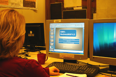
Students and faculty interested in learning more about GIS software can now access BusinessMAP Basics, a tutorial on the GRMC Web page. BusinessMAP 4.5 software is geared toward business and marketing tasks and was recently installed in the GIS lab in the GRMC to supplement existing GIS software.
The BusinessMAP Basics tutorial guides users through the basic functions of this new software and is supplemented by specific subject-oriented video tutorials created by ESRI that illustrate the tools being used in a project environment. Marketing and business faculty and students could use this tutorial to enhance classroom projects.
Users seeking information about geography can also access online map tutorials. These tutorials are of particular value for students for review, teachers for classroom instruction, and others who want to sharpen their map skills. The newest tutorial on the site is from the Maps and Cartography series: Map Projections. Map Projections teaches users about how maps are created using different map projections and provides examples of each type using maps from the Map Collection.
These online resources are available under the GIS and Maps and Atlases sections of the main GRMC Web page, www.bsu.edu/library/collections/gcmc. After completing the tutorials, users are asked to provide feedback, including suggestions for topics of future tutorials.
For more information on these and other resources, contact the GRMC staff at 765-285-1097.
Friday, January 18, 2008
GRMC Closed in Observance of Martin Luther King, Jr., Day
The Geospatial Resources & Map Collection in Bracken Library will be closed on Monday, January 21, in observance of Martin Luther King, Jr., Day.
Thursday, January 03, 2008
2007 Review for the Geospatial Resources & Map Collection
2007 By the Numbers in the Geospatial Resources & Map Collection
The statistics are in, and the Geospatial Resources & Map Collection was a busy place during the 2007 calendar year:
Maps circulated: 1067
Reference questions: 785
GIS resources used: 115
Materials used in the GRMC: 6,497
Instructional sessions: 21
Instructional sessions’ participants: 475
Plotter uses: 1,372
Contact the Geospatial Resources & Map Collection in University Libraries to find out more about resources for research and learning. Happy New Year!
December Events in the Geospatial Resources & Map Collection
Highlights from December 2007 in the GRMC
Staff of the Geospatial Resources & Map Collection provided an instructional session about using maps and atlases in social studies lessons to students in Social Studies Elementary Teaching Methods (SS397) on December 5. Students in the class learned about specific maps in the Collection, map publishers, and how to borrow maps for classroom activities.
University Libraries employees attended two Staff College sessions entitled A Day in the Life… on December 18. Participants learned about the daily responsibilities and interesting research opportunities that happen in the GRMC. Most were surprised to learn that in 2006 the GRMC hosted 3,884 visitors who used 15,982 maps and atlases. Participants also learned about daily life in Acquisitions and the Educational Resources Collection during the sessions.
The GIS Specialist assisted Frank Trechsel, Professor of Language and Linguistics in the Department of English, obtaining GIS data for Mexico and created detailed maps of specific areas for projects on Mexican-Indian dialects. Staff from the Social Science Research Center and Teachers College also used the GIS resources of the GRMC.
The GRMC also hosted a tour featuring visitors from China on December 7. Representatives from Shanghai Normal University toured the Map Collection, viewing several maps, atlases, and aerial photographs of their city.
The GRMC is open Monday through Friday from 8:00 A.M. to 5:00 P.M. Contact the staff for more information about using the resources of the GRMC for research and learning.
Subscribe to:
Posts (Atom)