In the Window: October 2006 GCMC Map Displays
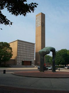
The "Map of the Month" for October was chosen to commemorate the Columbus Day holiday. Two copies of the Architectural Tour Map of Columbus, Indiana, were displayed. One side of the map shows the route of the architectural tours hosted by the Columbus Visitors Center, and the other side of the map displays photographs of buildings featured on the tour and information about the designs and architects. (The building shown is the First Christian Church, which was designed by Eliel Saarinen). The two maps were recently donated to the GCMC and update an earlier version of the map in the Collection.
Other maps displayed during October included Indiana's Haunted Hometowns, Indiana's Congressional Districts Map, a map of Baghdad and other maps related to news events.
Please visit the Geospatial Center & Map Collection in Bracken Library to view the map displays. Contact the Center if you would like to donate maps to the Collection.

No comments:
Post a Comment