University Libraries Add Rare Copy of 1942 Ostland Atlas to Collections
by Cecilia Bond, Cataloging and Metadata Services Librarian
University Libraries Library Insider article
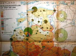
The University Libraries recently added a copy of the rare Ostland Atlas to its Archives & Special Collections Research Center.
Published in 1942 by the Nazis, the atlas was created for the civil administration for the German occupied eastern territories. Ostland is the name given to the occupied Baltic states that included Estonia, Latvia, Lithuania, and Belarus in 1941. The rare atlas includes 57 folded, color maps showing the occupied administrative area, its climate and vegetation, population demographics, agricultural status, industry, energy and economic features, traffic and roads, foreign trade in 1938, and history of the area to 1943.
Paul Stout, emeritus map librarian, acquired the atlas in the 1990's from a colleague who probably overlooked, as did Stout, its value because the atlas was in another language and its container was ragged and falling apart. The atlas was put in storage until it could be evaluated for completeness and context. When reviewing materials, Map Collection Assistant Melissa Gentry found the rare atlas safely wrapped and waiting to be appraised. The atlas was promptly cataloged and added to the collection.
According to WorldCat, only two libraries in addition to Ball State University have an original copy of this publication: the University of Oxford and the University of South Carolina.

No comments:
Post a Comment