Tuesday, January 30, 2007

More Google-related Maps

...and More Maps from Google

The Google Books search has recently added a new feature to some of its entries. When searching for a book in the library of Google Books, users can now find maps that map out the events of the book. Using the Google Books search, click on the "About this Book" feature. This section shows where the book may be purchased, libraries where the book may be borrowed, related books, references from scholarly works, and other editions of the book. Some books included in the Google library also include a map of the events of the book listed under the section "Places Mentioned in this Book." This feature is being added to more books, but the following are some of the books that include maps: Howards End by E.M. Forster, Les Miserables by Victor Hugo, Ivanhoe by Sir Walter Scott, and, of course, Around the World in Eighty Days by Jules Verne. These world maps include markers where events in the book took place with pages of the book referenced below the map. Recently a student teaching an elementary class about Around the World in Eighty Days created a game where the students mapped out the events of the book using maps from the Geospatial Center & Map Collection. And now Google allows readers to accomplish this with a click of the mouse.

January 2007 Map Displays

"New" Map Displays in the GCMC

The "Map of the Month" for January 2007 in the Geospatial Center & Map Collection was a USGS topographic map of Ellis Island in New York. Ellis Island opened as a new immigrant screening station in January of 1892.

A 2004 map of Iran is the featured map in the "Maps in the News" section of displays.

Student-assistant Casey Gentis created this "Happy New Year Map of the United States" for display. The map features place names in the United States with the word "new."

Also featured in the windows of the GCMC is a GoogleEarth image of Dolphins Stadium in Miami, site of the 2007 Super Bowl.

Visit the GCMC to view the map displays or to borrow maps for a project, class assignment, or to display during a speech or presentation.

Economic Maps from Yale

3-D Economic Maps from Yale

The G-Econ Project was designed by researchers at Yale to display the world's economic activity using a one-degree grid. A map of the world and maps of individual countries and data sets are available at the project website, http://gecon.yale.edu.

The basic metric is the regional equivalent of gross domestic product. The economic activity displayed on the maps matches closely to cities and areas of large industrial activity, as shown on this map of Canada. Most of the cities of Canada are along the border with the United States, and the economic activity matches that trend.

Professor William Nordhaus of Yale is the project director. The GIS lab in the Geospatial Center & Map Collection in Bracken Library is available for GIS users working on similar projects.


Friday, January 26, 2007

English Class Assignment in the Library

Scavenger Hunters in the GCMC

English 104 students in Elizabeth Nesbitt's classes were given an assignment to complete a scavenger hunt in Bracken Library. Students were asked to cite different materials found in the Library, and part of the assignment included citing a map that was related to their college major. Many of the students were surprised to find such a large variety of topics covered by maps and atlases in the Geospatial Center & Map Collection and Atlas Collection.

Students majoring in history and political science found hundreds of maps and atlases related to their majors. Many of the history students chose to cite actual maps dating from World War II. Others were interested in looking at maps about the Civil War, westward expansion, or Vietnam. A map showing the results of all of the presidential elections was a popular choice with political science students. Some students cited maps included in the Atlas of American Politics.

Sociology and anthropology students asked for maps related to Native Americans, life in ancient Egypt, or maps related to world religions. Science and natural resources and environmental management students were interested in maps about endangered species, water conservation, and a map of wildlife refuges. A student studying to become a meteorologist requested the map, Most Intense Tropical Storms of 1998. Some science students cited the map titled Earth at Night, but this map was also cited by economics students since the lights of the map show development.

A music student cited the Titanic Reference Map since the map discusses the music played on the ship. An art student cited a map found in the Atlas of Western Art History. English and writing majors cited the Map of the Limberlost, a map showing American folklore characters, a map about the Harlem Renaissance, Shakespeare's Britain, and the Literary Map of Indiana.

Sports management students cited maps from atlases on sports or specifically golf or the Soccer Unites the World or the Baseball Travel Map. A construction student cited a map about the architecture of Rome. Nursing students discovered many maps and atlases related to health issues. Many of the students used atlases for the assignment. The Tobacco Atlas includes many maps related to health and health education. Some of the students used maps in the atlas showing tobacco deaths, female smokers, and youth smokers, and maps showing where education is provided to help smokers quit.

Another atlas was used by students in nearly every major. The State of the World Atlas by Dan Smith includes maps about life expectancy at birth, quality of life, investment, world markets, debt, literacy, religion, health risks, reproductive rights, communication and media around the world, and biodiversity. So this atlas proved popular with students searching for a map related to many different types of issues related to many different majors.

This assignment not only taught students about how to use the library and write bibliography citations, but also provided an opportunity to learn about all the different resources the library has available for further research and learning. Please contact the Geospatial Center & Map Collection if interested in planning an assignment for the classroom.

Thursday, January 25, 2007

Historical Aerial Photography in the GCMC

Pictures of the Past: Aerial Photographs in the GCMC

GoogleEarth has popularized the use of aerial photography in research, and these images are becoming more common in everyday use. GoogleEarth is available on the computers in the GIS lab in the Geospatial Center & Map Collection. Digital images of current aerial photography for the state of Indiana is also available for download from the Indiana University GIS website. And the GCMC has digital access to the most recent aerial photography for Delaware County. But the Center is also an excellent resource for historic aerial photography from all over the United States and even parts of Australia.

Complete sets of aerial photography at 1:100-feet and 1:400-feet scales for Delaware County are available for research. The dates of the photography are 1974, 1979, 1982, 1985, 1987, 1992, and 1997. These sequential photographs are an excellent tool for viewing changes in the landscape of an area over time. Recently a graduate student in Architecture used four aerial photographs of the same site in Muncie dated at intervals of five years to study the development around her research site. The number of buildings added in each progressive photograph was quite dramatic.

Some development of Marion County can be studied using aerial photographs of the county in the GCMC. Two sets of aerial photographs at 1:100-feet scale from Marion County are available. The dates of these sets are 1985 and 1994.

The GCMC also has historic aerial photography in the 1:400 feet scale of other Indiana counties: Grant County, 1984; Hamilton County, 1985; Henry County, 1993; Madison County, 1985; Monroe County, 1993; and Randolph County, 1993. Smaller aerial photographs of other Indiana counties are also available as reference materials in the GCMC: Boone County, 1939 and 1955; Carroll County, 1938, 1939, 1951, 1952, and 1958; Pulaski County, 1938 and 1957; and White County, 1938, 1939, 1951, and 1958.

The GCMC also has historic orthophotoquad maps and orthophoto maps of most of the United States. Orthophotoquad maps are aerial photographs layered onto the USGS 1:24,000 topographic quadrangle maps. The orthophotomaps are usually color versions of similar maps. Most of these maps are 1:24,000-scale maps. The GCMC contains sets of maps from all but nine states--Arizona, Kansas, Kentucky, Montana, New Jersey, New York, North Dakota, Ohio, and Rhode Island. The GCMC has orthophotoquads from all other states. The sets of maps from Florida, Georgia, North Carolina, Texas, and Virginia are exceptionally thorough. The maps of Alaska include satellite image maps and radar image mosaic maps. (The image of the region of Ugashik is shown above).

The GCMC also houses sets of aerial photographs of parts of Australia. The largest coverage is of South Australia. A new (2005) set of topographic maps of New South Wales was recently added to the Collection.

With the exception of the smaller reference materials of Boone, Carroll, Pulaski, and White Counties, the entire collection of aerial photography may be checked out from the GCMC for two weeks. Please contact the GCMC with any questions about using historic aerial photography for research and learning.

Thursday, January 11, 2007

Historical Maps on the Web

Making History on Desktops

Several historical resources are now available on the Internet, matching historic maps and charts with modern technology:

The National Oceanic and Atmospheric Administration has made available 21,000 maps and charts dating from 1655 to 2001. This site includes downloadable images of aeronautical charts, base maps, city plans, Civil War maps, fishing/bathymetric charts, topographic maps, plat maps, nautical charts, and even sketch maps. Maps can be located through a keyword search or by type, year, or region. (The map shown is a map of the battlefield at Antietam). This site is located at http://historicals.ncd.noaa.gov/historicals/histmap.asp.

Another useful site lists over 1,200 historic map images available on the Internet: Map History/History of Cartography: The Gateway to the Subject: This site is "the only comprehensive listing of its kind...and is updated at least every two months." The listing of maps is organized by continent and has a separate section of thematic maps. This site is located at http://www.maphistory.info/webimages.html.

Another historical resource was added in November 2006 to commemorate Geography Awareness Week. Sixteen maps from the David Rumsey Historical Map Collection were uploaded to the featured content layer of Google Earth. Users can view the historical maps overlay and compare the old maps to the modern world. More information about the David Rumsey Historical Map Collection is available at http://www.davidrumsey.com/.

The Geospatial Center & Map Collection and the Archives & Special Collections Research Center in Bracken Library contain historic maps and atlases of various places dating back to the 19th century. Please contact the Center for more information about using these historic resources in research.

Monday, January 08, 2007

2006 GCMC Events

2006: Geospatial Center & Map Collection Year in Review

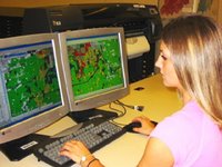
Students from a variety of classes visited the GCMC in 2006 to use the maps, atlases, GIS software, and other resources available in the Center. In fact the list of classes is extremely diverse: Geography, Urban Planning, Historic Preservation, Landscape Architecture, Architecture, Archaeology, Anthropology, Geology, History, Art, Communications, Journalism, Modern Languages and Classics, Creative Writing, Music, Global Studies, Construction Management, and Biology. The Center also hosted students working on projects from Elementary Education, Social Studies methods, Natural Resources and Environmental Management, Economics, Political Science, Physics and Astronomy, Sociology, Spanish, and English.

Visitors to the GCMC were international: The Center hosted tours to visitors from Deyang, China; Seoul, South Korea; Malawi; the Republic of Georgia; and Germany.

Keeping track: 2,487 items were circulated from the GCMC in 2006; 1,636 reference questions were researched using 12,356 items in the room; GIS software was used 228 times; 1,093 people used the plotter for printing; 34 maps were circulated through Interlibrary Loan; and 22 classes with 304 participants were given instructional sessions.

Contact the GCMC for information about any of these services and resources. The Center is open Monday through Friday from 8:00 to 5:00.