Wednesday, December 01, 2010

World AIDS Day Map of HIV/AIDS from Ball State University Libraries

World Aids Day: Map of HIV/AIDS from Ball State University Libraries

Since 1987, December 1 has marked World Aids Day, an international movement commemorated each year to raise awareness of HIV/AIDS issues, prevention, and the promotion of a search for a cure.

The map shown above (click to view larger) depicts the millions of people around the world living with HIV/AIDS as of 2007. The map is from The Penguin State of the World Atlas by Dan Smith, which is available from the Ball State University Libraries’ GIS Research and Map Collection (GRMC) and the Atlas Collection on the second floor of Bracken Library.

The circle graphs depict the percentages of the population and the millions of people in each region of the world who are infected with HIV/AIDS. A quick glance shows the massive crisis affecting Sub-Saharan Africa with 22.5 million people infected with the disease, while 19% of the population of Oceania is infected.

This atlas features numerous maps depicting social issues. These maps can be used for papers and presentations for research and learning.

Atlases circulate for 28 days or longer. For information about how to cite maps, please visit the GRMC Web page or contact Melissa Gentry at 765-285-1097.

Tuesday, November 23, 2010

Maps of Korea Available from Ball State University Libraries

Maps in the News: Yeongpyeong Island, Korea

Recent events have once again placed the Korean Peninsula in the world spotlight: The GIS Research and Map Collection (GRMC) on the second floor of Bracken Library contains hundreds of maps of the Korean Peninsula and North and South Korea, including topographic maps identifying Yeonpyeong Island in the Yellow Sea (Click to view map above larger).

The GRMC has three different sets of topographic maps of the Korean Peninsula, some created by the Army Map Service. These topographic maps are available at 1:50,000; 1:250,000; 1:500,000 scales.

The GRMC also houses a set of city plan maps of cities from North and South Korea, including Ulsan, Keijo, Masan, Pusan, Pyongyang, Chinnampo, and Najin Rashin. Updated maps of Pyongyang, Seoul and Inchon are also available.

Numerous maps of the two countries or the combined peninsula are also available for research and learning, including the National Geographic comprehensive map The Two Koreas: Forgotten War. Bracken Library is a federal depository library, so the GRMC receives updated maps of Korea from the Central Intelligence Agency and nautical charts from the National Geospatial Intelligence Agency.

The Atlas Collection on the second floor of Bracken Library also houses resources about Korea. Several road atlases of Korea and tourist atlases of Seoul are available. Many of these atlases are available in English and Korean.

For more information about these resources, please contact the GRMC at 765-285-1097 or email Melissa Gentry at mgentry@bsu.edu.

Thanksgiving Break Hours in the Ball State University Libraries’ GIS Research and Map Collection

The GIS Research and Map Collection (GRMC) on the second floor of Bracken Library will be closed Thursday, November 25 and Friday, November 26 for Thanksgiving Break. The GRMC will reopen on Monday, November 29 at 8:00 a.m.

Researching the History of Your House Presentation at Ball State University Libraries

History Detectives Presentation at Ball State University Libraries

“History Detectives: Researching the History of Your House” will be presented by Susan Lankford, Director of the Ball State University Center for Historical Preservation, on Tuesday, November 30 at 7:30 p.m. in Bracken Library, room 104. This free program is sponsored by the Friends of the Alexander M. Bracken Library and is open to the public.

The map shown above is from the Muncie Sanborn Fire Insurance Maps collection available in the University Libraries’ Archives and Special Collections and from the Digital Media Repository. These maps are an excellent starting point for researchers interested in the history of local buildings and neighborhoods.

For more information, contact John B. Straw, Assistant Dean for Digital Initiatives and Special Collections in the University Libraries and Executive Secretary of the Friends of the Alexander M. Bracken Library at 765-285-5078.

Thursday, November 18, 2010

Smoking Maps from Ball State University Libraries

Tobacco Maps from Ball State University Libraries

The American Cancer Society is marking the 35th “Great American Smokeout” today by encouraging smokers to use the date to make a plan to quit. Quitting smoking is not easy but the American Cancer Society states that to have the best chance of quitting successfully, smokers need to know what they’re up against, what their options are, and where to go for help.

The map above shows the percentage of the population who smoke cigarettes in each country (from 2005 data). The top map shows the percentage of men who smoke. The lower map shows the percentage of women who smoke. “Although fewer women smoke than men, there is a worrying increase among younger women in many countries.”

This map is from The Penguin State of the World Atlas by Dan Smith. The atlas is available in the Atlas Collection on the second floor of Bracken Library or from the GIS Research and Map Collection (GRMC). Another valuable atlas in the collection that features maps on various issues is The Tobacco Atlas.

Atlases can be useful educational resources as visual aids in papers and presentations, and the images from atlases can be easily scanned. Atlases circulate for 28 days or longer.

For more information about using maps from atlases in education and research, please contact the GRMC at 765-285-1097.

Tuesday, November 16, 2010

Geography Awareness Week at Ball State University Libraries November 14-20

Freshwater Map Presented for Geography Awareness Week

Geography Awareness Week is an annual celebration enacted by Congress in 1987 that encourages educational experiences that draw attention to geo-literacy and the importance of geography education. During Geography Awareness Week 2010, the National Geographic Society’s theme is learning about freshwater and how it connects to geography.

National Geographic published a map in April 2010 called World of Rivers: A New Mapping of Every River System. The Ball State University Libraries’ GIS Research and Map Collection (GRMC) is displaying a copy of this map in its windows on the second floor of Bracken Library to commemorate Geography Awareness Week.

The map describes rivers and their significance in human civilization: “Rivers and lakes store less than half a percent of Earth’s fresh water, but they are the lifelines of human history—where people settled, farmed, traded, built cities, explored.” The map depicts all the major rivers of the world and their “intricacies” as smaller tributaries feed into larger rivers.

The verso of the map describes the “hidden water” consumed in the production of products. “It’s called virtual water: the amount of water used to create a product.” For example, the virtual water in meat like pigs, cattle, and chickens is the water the animals drink and the water used to grow their feed and clean their waste and process the edible end product. In order to produce one pound of beef, it takes 1,857 gallons of water.

Cotton is an example given on the map of a water-intensive crop—it takes a lot of water to transform cotton into fabric. One pair of blue jeans requires 2,900 gallons of water to produce. One cotton t-shirt takes 766 gallons of water.

National Geographic clarifies that “more important than any product’s virtual-water total is whether the region it comes from has sustainable water to grow the crop.” The challenge will be to increase water-use efficiency in the production of future products.

This map is encapsulated for convenient display and can be circulated from the GRMC for two weeks or longer. For more information about using maps for education and research, please contact the GRMC at 765-285-1097.

Thursday, November 11, 2010

Maps of Jerusalem Available from Ball State University Libraries

Maps in the News: Jerusalem

Jerusalem is once again in the international spotlight. Ball State University Libraries’ GIS Research and Map Collection on the second floor of Bracken Library contains over 140,000 maps and other geographic resources, including dozens of maps of the city of Jerusalem.

The National Geographic Society in 2008 published a map called Crucible of History: The Eastern Mediterranean which features a map of Jerusalem’s holy ground on the verso. The map includes historical notes and a timeline, a map of the Old City of Jerusalem, and colorful illustrations of temples and domes.

The Central Intelligence Agency published a map in 2006 of Greater Jerusalem. This map shows settlements, refugee camps, fences, and walls. A chart on the map describes plans for new settlements.

Heart of the Middle East from 2002 is another map published by the National Geographic Society that features an inset map of Jerusalem. This map includes ancillary maps depicting conflicts in the region since 1948, religions, and oil and water on the verso.

The GRMC also includes several maps of the Old City of Jerusalem (shown). Some of the maps date back to when East Jerusalem was controlled by Jordan.

Archaeology of Jerusalem: First Temple, Second Temple, and Byzantine Periods is actually four maps included on one sheet. This map includes major archaeological remains that are visible today and a Diagram of Madaba map. Jerusalem: Pictorial Map and City Guide includes a map of the historic buildings of the city and line-art sketches of the actual architecture.

Maps from the GRMC circulate for two weeks or longer.

For more information about these maps or any of the cartographic resources, please contact the GRMC Monday through Friday at 765-285-1097.
Monday, November 01, 2010

Election Cartographic Materials Available from Ball State University

Map the Vote: Political and Election Cartographic Materials from Ball State University Libraries

The GIS Research and Map Collection (GRMC) has created cartographic subject guides to assist researchers searching for geographic materials related to multiple academic fields. Ball State University Libraries includes a wealth of valuable cartographic resources on numerous topics, and the subject guides include materials in the GRMC, the Atlas Collection, Educational Resources Collections, the General Collection, Government Publications, Oversize, and the Reference Collection. These cartographic subject guides are available in PDF-format on the GRMC Web page “Research Tools” section at http://cms.bsu.edu/Academics/Libraries/CollectionsAndDept/GISandMaps/MapCollection/ResearchTools/SubjectGuides.aspx.

Students of political science or others interested in the election process may wish to use the subject guide Cartographic Resources for Political Science and Elections Research. Maps and other cartographic resources can be an ideal tool for illustrating various information and statistics about elections. The widely-used “blue states and red states” explanation of states’ party affiliations has become a cultural phrase and was made popular from an election map from the 2000 presidential election.

This cartographic subject guide lists the many maps and atlases about elections—current and historical—available from Ball State University Libraries. In the GRMC researchers can review maps of the newly-drawn Congressional districts, presidential election results since 1789, and even state and local city council districts and precinct boundaries.

The Atlas Collection on the second floor of Bracken Library can also be an invaluable resource for political research. Atlases about specific political themes are available. Atlas of American Politics, Atlas of American Women, Atlas of U.S. Foreign Relations, Atlas of World Affairs, Historical Atlas of Political Parties in the United States Congress, 1789-1989, and Student Atlas of World Politics are all available from the Atlas Collection. Ball State University Libraries also includes rare atlases about the 2000 and 2001 elections in Kosovo.

Maps from the GRMC circulate for two weeks or longer. Atlases may be circulated for 28 days or longer.

Please contact the GRMC Monday through Friday from 8:00 to 5:00 for more information about these resources or other cartographic subject guides.

Wednesday, October 27, 2010

Ball State University Libraries' Collection of Indonesia Maps


Maps in the News: Indonesia

Natural disasters have once again put the archipelago country of Indonesia in the news: The nation has been hit by an earthquake, tsunami, and volcanic eruption all in a matter of days. The GIS Research and Map Collection (GRMC) in Bracken Library has a diverse collection of maps of Indonesia available for researchers.

The National Geographic Society featured a map of Indonesia in its magazine in 1996. This map depicts a basic location map of the country’s 17,000 islands on one side with several ancillary maps on the verso. A contour map is centered on the verso circled by ancillary maps showing economic activity, a map of timber exports, a population map, and maps depicting rainfall amounts and climate zones. The map also features colorful illustrations of the unique plant and animal species native to Indonesia.

Updated maps of the nation including the addition of the country East Timor are also available from the GRMC. Individual maps of Sumatra, Bali, Java, and Sulawesi are also included in the collection. As an archipelago, Indonesia is also featured on dozens of nautical chart maps in the GRMC including maps produced by the U.S. National Geospatial Intelligence Agency and the Royal Australian Survey Corps. Maps of Jakarta are also available, and many of the maps are presented in English, Indonesian, German, Dutch, Japanese, and French.

The Atlas Collection on the second floor of Bracken Library also includes several resources about Indonesia. The collection includes Atlas Republik Indonesia, Historical Atlas of Indonesia, Illustrated Atlas of Indonesia, Indonesian Travel Atlas, and Road Atlas of Indonesia. Atlases of Jakarta are also available.

Maps from the GRMC circulate for two weeks or longer. Atlases may be circulated for 28 days or longer.

For more information about these cartographic resources, please contact the GRMC at 765-285-1097.

Friday, October 15, 2010

Weekend Getaway Maps from Ball State University Libraries


Fall Breaking Away: Central Indiana Weekend Getaway Maps from Ball State University Libraries

The GIS Research and Map Collection (GRMC) on the second floor of Bracken Library offers over 140,000 maps for circulation. Some of the most popular maps in the collection include convenient travel maps of tourist destinations. Ball State students planning a weekend getaway for this weekend or for the upcoming fall break may wish to check out some of the maps of places around central Indiana.

This is the final weekend of the Parke County Covered Bridge Festival. This annual event is headquartered in Rockville and includes guided tours of the covered bridges and crafters, vendors, and entertainment. The GRMC has available two different maps featuring the covered bridges of Parke County. The map of Parke County shown above features points of interest and information about camping sites, horseback riding, and boat rental and canoeing on the Wabash River and at the Raccoon Recreation Area near Hollandsburg.

A closer destination for Ball State students is the Mounds State Park in Anderson. The map shown above from the GRMC details the trails winding through the park and shows contour lines.

Another resource available from the GRMC is Indiana State Parks: A Guide to Hoosier Parks, Reservoirs, and Recreation Areas by John Goll. This book features detailed maps and helpful information about visiting any of the state parks throughout Indiana and is an excellent guide for campers, hikers, fishermen, boaters, hunters, and nature lovers.

Maps from the GRMC circulate for two weeks or longer. And many of the travel maps are waterproof so they can be used on excursions.

For more information about these maps or any other resources, please contact the GRMC at 765-285-1097 Monday through Friday from 8:00 to 5:00 p.m.

Wednesday, October 13, 2010

International Festival October 14 at Ball State University

Amazing Taste and iFest at Ball State University October 14th

The Ball State University Rinker Center for International Programs, the Multicultural Center, and the University Program Board are joining forces with Ball State Dining Services to sponsor this year’s International Festival. The event will be called “The Amazing Taste: Global Food Fair and iFest,” and will be held in the lawn between DeHority Park and Woodworth Halls on October 14 from 5-8 P.M.

The University Libraries’ GIS Research and Map Collection (GRMC) will be providing maps and posters for the country booths at the iFest. Every week the GRMC provides posters for the Culture Exchange at the Rinker Center for International Programs, and many of these countries will be represented at this event. Some of the countries represented are Jamaica, Afghanistan, Germany, Korea, France, Spain, Thailand, and Vietnam.

Ball State Dining Services will host an elaborate multicultural menu from around the world. Students can use their meal card for this event. Visitors can watch sword fighting and martial arts demonstrations, get henna tattoos, watch and participate in salsa and belly dancing, get caricatures and names written in various languages, listen to the steel drum troupe, play Bocce ball, and have their picture taken with live camels. (Bring your own camera).

For more information about the menu and costs, please visit
http://cms.bsu.edu/CampusLife/Dining/AmazingTasteMenu.aspx.

Maps of Chile' Available from Ball State University Libraries


Maps in the News: Chile’

The Ball State University Libraries’ provides resources about places in the news. The GIS Research and Map Collection (GRMC) on the second floor of Bracken Library contains a large collection of maps and other cartographic materials of Chile’ and other areas of South America. And the Atlas Collection in Bracken Library also provides resources about the geography of Chile’.

The Atlas Collection includes an atlas published by Lonely Planet that details travel information for Chile’ and Easter Island. Guia Caminera de Chile, Atlas Geografico de Chile, Atlas Regionalizado de Chile, and Atlas de la Republica de Chile are atlases about Chile’ published in Spanish. Colonial Hispanic Cartography of Chile’ is an atlas published in 1952 that includes reproductions of early maps of Chile’ originally published in 1924.

The GRMC includes hundreds of maps of Chile’ and South America. A set of topographic maps depict 16 different cities in Chile’. The GRMC also includes tourist maps of Chile’ and Santiago, maps of Patagonia, the Chile’-Peru border region, and Tierra del Fuego. Nelles Maps produced a map of Chile’ available from the GRMC that includes detailed maps of Santiago, Easter Island, Peninsula Valdes, Arica, Iquique, Antofagasta, La Serena, and Punta Arenas. The map of Santiago shown above was published in 1949. There are also maps of Valparaiso and Vina del Mar. The GRMC also includes nautical charts published by the National Imagery and Mapping Agency that detail the areas along the Chilean coast. Che's Route: Ernesto Guevara's Trip Across South America is another map available from the GRMC that includes Chile'.

Maps from the GRMC circulate for two weeks or longer. Atlases circulate for 28 days or longer.

For more information about these resources, please contact the GRMC at 765-285-1097.

Friday, September 10, 2010

September 11 Map Available from Ball State University Libraries

September 11 Map of Flight 93 National Memorial Available from Ball State University Libraries

Almost immediately after the crash, visitors began arriving in Somerset County, Pennsylvania, to see the place where Flight 93 ended on the morning of September 11, 2001. A temporary memorial was created on a hilltop overlooking the crash site, and more than 150,000 visitors come to the spot each year.

In 2002 the Flight 93 National Memorial was included as a unit of the National Park Service. Family members, area residents, subject experts, and the National Park Service have worked with a Federal Advisory Commission to make recommendations on the design, boundaries, and management of a permanent National Memorial. An international competition resulted in the selection of a design for a memorial to be built at the Flight 93 crash site.

The map above shows the location of the temporary memorial. The Flight 93 National Memorial map was created by the National Park Services and is available in the GIS Research & Map Collection (GRMC) on the second floor of Bracken Library. This map includes information about the crash and details of the temporary and permanent memorials.

Maps from the GRMC circulate for two weeks or longer. To learn more about the development of the Flight 93 National Memorial and plans for the permanent memorial, visit www.nps.gov/flni.

Wednesday, August 18, 2010

Women's Suffrage Maps from Ball State University Libraries Mark 19th Amendment Anniversary


Mapping Women’s Suffrage on the Anniversary of the 19th Amendment

Today, August 18, marks the 90th anniversary of the ratification of the 19th Amendment to the United States Constitution. The amendment prohibited the state and federal government from denying any citizen the right to vote because of gender, thus giving many women in the United States the right to vote.

Tennessee was the 36th state to ratify the 19th Amendment on August 18, 2010, and it was subsequently ratified by 12 other states. Mississippi ratified the 19th Amendment on March 22, 1984, after rejecting it in March of 1920.

According to The Penguin Atlas of Women in the World available in Ball State University Libraries’ Atlas Collection and GIS Research and Map Collection (GRMC), “Native American women and men who lived on reservations were not granted citizenship, and thus the right to vote, until 1924, four years after other U.S. women.” Also women in Puerto Rico “did not win suffrage until 1929, when it was granted only to ‘literate women.’ They won universal suffrage in 1935.”

The map shown above (click to enlarge) depicts where women were allowed to vote in the United States prior to the 19th Amendment in 1919. The map is from the United States History Atlas available in the GRMC.

The chart shown is from The Penguin Atlas of Women in the World and displays the gap between men’s and women’s suffrage in selected countries around the world.

Maps from the GRMC circulate for two weeks or longer. Atlases circulate for 28 days or longer.

For more information about maps, atlases, or other cartographic resources available from University Libraries, please contact the GRMC Monday through Friday from 8 a.m. to 5 p.m. at 765-285-1097.

Friday, August 13, 2010

Back-to-School Resources from Ball State University Libraries' Cardinal Scholar


Back-to-School Resources from the GIS Research & Map Collection

Students and faculty returning to the Ball State University campus will be able to access important classroom resources created by the GIS Research and Map Collection (GRMC) from the University Libraries’ Cardinal Scholar institutional repository at http://cardinalscholar.bsu.edu/. Cardinal Scholar allows users to access these invaluable resources from any location with Web availability.

Students and other researchers writing papers or preparing presentations may consider using maps from the GRMC or the Atlas Collection as visual aids to add interest and impact. These collections include maps and other cartographic images that visually depict numerous current issues. The new online guide, Using Maps and Atlases as Resources for Papers, Posters, and Presentations, details how cartographic images can enhance research. The guide can be accessed from Cardinal Scholar at http://cardinalscholar.bsu.edu/1079/.

The State of the World Atlas Images (shown above) is a poster available from the GRMC in Cardinal Scholar that gives examples of the different maps, charts, photographs, and other images available from atlases in the Atlas Collection or the GRMC. This poster was created using a single atlas, The Penguin State of the World Atlas, which is available in the Atlas Collection and the GRMC and displays numerous topics like war, child labor, obesity, smoking, women’s issues, and the environment. This resource can be accessed from Cardinal Scholar at http://cardinalscholar.bsu.edu/1083/.

Faculty, students, and other researchers using maps and atlases can also find information about citing these resources in Cardinal Scholar using the Guide to the Citation of Maps and Atlases. This guide describes the format for citing cartographic resources and provides examples from University Libraries. The guide can be accessed at http://cardinalscholar.bsu.edu/1080/.

Teachers and student teachers headed back to the classroom can find numerous games, posters, lesson plans, map worksheets, cartographic tutorials, and other resources in Cardinal Scholar. These classroom resources were developed for K-12 teachers and can be browsed by choosing “GRMC” as the creator. Larger posters from Cardinal Scholar can be printed on the large-format plotters located in the GRMC on the second floor of Bracken Library. A new online guide for teachers, Guide to Finding Resources for the Classroom Using Ball State University Libraries’ Cardinal Scholar, describes many of the available materials and can be accessed at http://cardinalscholar.bsu.edu/1081/.

For more information about using these resources or finding other materials available from Cardinal Scholar, please contact the GRMC Monday through Friday at 765-285-1097.

Thursday, August 12, 2010

Academic Year Hours at Ball State University Libraries

New Hours in the GRMC

Summer in the GIS Research and Map Collection (GRMC) officially ends on Monday, August 16. Starting on Monday, the GRMC will be open Monday through Friday from 8:00 a.m. to 5:00 p.m.

August Map Exhibits in Ball State University Libraries

Italy, India, Indonesia, and Indiana State Fair: August Map Displays at Ball State University Libraries

The GIS Research and Map Collection (GRMC) on the second floor of Bracken Library is displaying two map exhibits in the windows for the month of August. The “Map of the Month” is actually three maps—a map of Italy, a map of India, and a map of Indonesia. These are the settings for the book and movie “Eat, Pray, Love,” which opens tomorrow.

A map of the Indiana State Fairgrounds created by the GRMC is also featured as a separate exhibit. This map will be displayed until the end of the Indiana State Fair on August 22.

For more information about the maps in the GRMC, please call 765-285-1097 Monday through Friday.

Wednesday, August 04, 2010

A Summertime of Fun: GIS at the Indiana State Fair

The Indiana Geographic Information Council (IGIC) will be hosting a tent in the new Boy Scout Camp Area at this year’s Indiana State Fair, which begins Friday, August 6 and runs through August 22. The IGIC booth will be open from 10 am to 10 pm each day.

The IGIC has developed a State Fairgrounds orienteering map that will lead visitors to various points of interest around the fair that include natural, human, and historical sites of interest. As much as possible, completion of the orienteering activity will meet one or more requirements of Scouting rank advancements. Although the focus will be on supporting the Boy Scouts, this activity will be available to all visitors to the Fair. Visitors can also access GIS and IndianaMap data on a touch-screen kiosk located inside the Normandy Barn.

For more information about these activities, please visit the IGIC Web page at www.igic.org. For more information about the Indiana State Fair, visit www.indianastatefair.com.

Wednesday, July 14, 2010

GIS from iTunes

GIS Software Available from iTunes

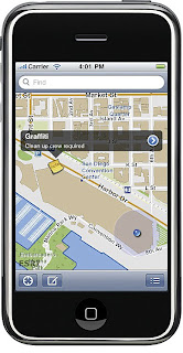
ESRI has made its GIS software, ArcGIS, available as a free download from the iTunes app store for the iPhone, iPad, and iPod Touch. The app provides access to ArcGIS Online, and allows users to navigate map galleries, access GIS data, display and zoom to a current location, and retrieve detailed map metadata.

Users can perform a keyword search and get access to relevant information. The search finds places, companies, and points of interest. The “Find Maps” button also allows users to view maps available online and add their own mapping service. Map tools allow users to find an address and coordinates of a location and measure area and distance. Topographic maps and Bing maps and aerial imagery can also be accessed. GIS information sharing with other iPhone users is encouraged.

For more information, please visit the ESRI Web page or ArcNews Online: http://www.esri.com/news/arcnews/summer10articles/arcgis-for-iphone.html

Wednesday, June 30, 2010

New Cartographic Materials in Ball State University Libraries


What’s New in the GIS Research & Map Collection?

The GIS Research & Map Collection (GRMC) is constantly updating its collection of maps, atlases, computer software, and other cartographic resources. New materials are being added nearly every week this summer.

The GRMC has a special section of maps that are available for use in classroom displays or for speeches and other types of presentations. Staff of the GRMC have collected large maps of nearly every country in the world and encapsulated them in plastic so that they can be easily mounted to any surface. New display maps are now available of Panama, Switzerland, Mongolia, Korea, Kenya, South Africa, New Zealand, and the countries of Oceania.

The GRMC has also recently acquired a reconnaissance aerial photograph of Omaha Beach. This map shows the actual D-Day invasion from 1944.

The GRMC also has added new reference books to the collection: Children Map the World: Selections from the Barbara Petchenik Children’s Map Competition is a book featuring maps drawn by children ranging in age from 4 to 15 and representing 37 countries. This map competition is sponsored by the International Cartographic Association as a memorial to Barbara Petchenik, a cartographer who studied how children comprehend maps. The maps (shown above) represented are truly works of art, and the book presents an interesting study in cartography.

Another new interesting book featuring a different type of cartography is Off the Map: The Most Amazing Sights on Earth as Seen by Satellite. This book features images from the Google Earth satellite images. The book showcases manmade buildings, crop and sand dune formations, high-security areas, and other interesting sights from around the world.

Maps from the GRMC circulate for two weeks or longer. Books located in the GRMC are reference materials but may be used in the classroom and for other presentations.

For more information, please contact the GRMC at 765/285-1097 or visit Monday through Friday from 7:30 A.M. to 4:30 P.M.


Thursday, June 10, 2010

Ball State University Storm Chasers Update

Ball State University Storm Chasers Hit the Road

Reprinted from the BSU Daily News, Kelly Dickey

After their first day chase across Kansas and finding a safe spot on a dirt road, David Call’s geography class found what they hoped to find throughout the summer: a tornado. Call, an associate professor of geography at Ball State University, led his class of storm chasers to the Colorado-Kansas state line to witness a tornado develop on their first day in the field on Tuesday, May 25. “The chances of seeing a tornado on the first day out on the field is less than 10 percent,” Call said. “The rule of thumb is a good chaser in the Great Plains will probably see about one tornado out of every 10 chase days,” he said. “Some days are better in terms of prospect tornados.”

Call said the storm leading up to the tornado was better than most of the storms last year’s group experienced. “Last year the weather pattern was very poor for storms,” he said. “This year we feel more confident and we have a decent shot at seeing another tornado.”

Call and geography professor Reuben Allen are leading a group of 10 Ball State University students to the Great Plains for a trip in search of severe weather. This group of students and faculty is part of the Geography 490 Field Observation of Severe Local Storms class. Unlike with the Ball State storm chasing team, this class gives students the opportunity to earn six credit hours while studying storms up close.

This is the third year Call has led a group of students to study storms. In the last two years, the groups have driven to South Dakota, Texas, Colorado and Missouri, with routes changing according to where they will find severe weather. The trip usually covers about 8,000 miles. The course starts with one week of training in which students learn the basics of how storms are formed; they study maps and atlases and learn how to use weather instruments. The day they depart, they make sure they have everything they need—laptops, maps, walkie talkies, a GPS, weather instruments and first aid kits.

Junior John Rarick said it was an exciting opportunity that he wouldn’t have been able to experience in the classroom. “In the classroom you have to identify parts of a storm structure, but that’s just a picture in a textbook,” he said. “No picture can compare. It was an amazing experience to see the whole thing as it evolved.”

Call said that the group picked a storm they thought would most likely produce a tornado. After 150 miles of traveling around Kansas, they saw the storm drop a tornado. “I’m proud of how the students worked together,” he said. “I help with things, but they did a lot of the work with the forecasting and planning. They did the things we needed to cover the distance and see the tornado.”

According to Call, some of the final decisions come down to luck, but a lot of it has to deal with how well the students work together. Rarick said it’s impossible to predict if they’ll see more tornados based on their one sighting. “We pretty much have no idea what will happen weeks from now,” he said. “It comes down to the people involved, not just the climate model at the time.”

Rarick believes the chase has been interesting, and he’s excited to see as many types of weather conditions as possible. “It’s definitely been exciting,” he said. “I’ve always been interested in severe weather. This was too good of an opportunity to pass up.”

The storm chasing group will remain on the road for about another week to ten days.

FIFA World Cup Map Exhibit at Ball State University Libraries

The World of Soccer: FIFA World Cup Map Exhibit at Ball State University

Opening festivities are beginning in South Africa for the FIFA World Cup soccer/football championship. The GIS Research & Map Collection (GRMC) in Bracken Library has created a special exhibit commemorating the competition.

Visitors can view the National Geographic Soccer Unites the World map, which features a map detailing World Cup participant nations, players, a historical timeline and statistics about the sport. The verso of this map is also displayed, showing the rules of the game.

The GRMC created a special map for the 2010 World Cup. This map identifies the 32 qualifying nations and marks the previous winning teams. The map displays photographs of players and fans from past competitions, including Pele’ of Brazil and Bobby Moore of England.

The map will be exhibited in the windows of the GRMC on the second floor of Bracken Library through the duration of the World Cup, ending on July 11.

For more information about special maps from the GRMC, please contact the staff at 765/285-1097.

Thursday, June 03, 2010

Maps of Gaza Strip Available from Ball State University Libraries GIS Research & Map Collection

Maps in the News: The Gaza Strip, Korea, South Africa

The GIS Research & Map Collection (GRMC) on the second floor of Bracken Library houses 140,000 maps that can be used for research and learning. Many of the maps can be used to interpret current events. For example, the GRMC includes a variety of maps of the Gaza Strip.

The current “Maps in the News” exhibit in the windows of the GRMC features an aerial photograph of the Gaza Strip from 2005. This view of the area identifies Israeli-developed areas, the Oslo-defined settlement zones and security perimeter, the United Nations Relief and Work Agency for Palestine Refugees camps, Palestinian-populated areas, border crossings, and roads.

The GRMC also includes maps of the Gaza Strip produced by the Central Intelligence Agency and nautical charts of the Mediterranean area. Maps of Israeli settlements in Gaza available from the GRMC date back to 1980.

The Atlas Collection, also located on the east side of the second floor of Bracken Library, includes an atlas called The Gaza Strip and West Bank: A Map Folio. This atlas features maps showing natural resources, economic activity and land use, selected water resources, Israeli-controlled land, transportation routes (shown) and other maps.

New materials are also available for places in the news: The GRMC has acquired a 2009 map of South Africa, host country of the World Cup Soccer. Two Koreas is a map published in 2007 by the National Geographic Society which features an ancillary map showing military and nuclear capacity and a fact box graphic showing military forces and spending.

Maps from the GRMC circulate for two weeks or longer. Atlases circulate for 28 days or longer.

For more information about these maps, please contact the GRMC Monday through Friday from 7:30 A.M. to 4:30 P.M. during the summer.

Wednesday, May 19, 2010

Summer Hours at the BSU GIS Research & Map Collection

Summer Academic Hours in the Ball State University GIS Research & Map Collection

The GIS Research & Map Collection on the second floor of Bracken Library will be open during the summer Monday through Friday from 7:30 A.M. to 4:30 P.M.

Cross-Country Bike Tour Uses BSU Maps

Cycling Infrastructure: Ball State University Students Ride Across America

Two landscape architecture students from Ball State University completed a study of the bicycling infrastructure of the United States by traveling around the country themselves via bicycle. David Bader and Patrick Beyer are fourth-year students and avid bicyclists, so the two decided to conquer a unique learning experience where they would study the infrastructure of different cities around the United States firsthand from their own bicycles.

Prior to the trip, Bader and Beyer visited the GIS Research & Map Collection (GRMC) in Bracken Library to review maps depicting the topography of the areas in which they would be riding their bikes. The students used several topographic maps to help plan their journey. The GRMC also has a collection of biking tour maps that also proved to be useful. The students determined a route in which they could bicycle for part of the way and take hybrid trains to connect them to the next city: http://cyclinginfrastructure.com/route.html.

Beyer departed from Indianapolis on February 21, and Bader left via train from Cleveland. Beyer explored Vancouver during the Olympics and then met up for the rest of the trip with Bader in Seattle, Washington. The students biked from Seattle to Portland, Oregon. By train they reached San Francisco, and travelled by bike to Monterey and Los Angeles, California. By March the two had reached San Antonio, Austin, and Houston, Texas. Then the next stops were New Orleans, Louisiana, and Baltimore, Maryland. They biked from Baltimore to New York City and took the train back to Chicago.

The students took time in each of the cities they studied to really analyze the logistics and challenges of riding a bike in that particular city. “Each city has its own unique challenges and many offer examples of remedial landscapes.” The Cycling Infrastructure Blog at http://cyclinginfrastructure.com/index.html produced by the students “documents precedent landscapes, natural environment, and human culture experienced along the route.”

Contact the GRMC at 765/285-1097 for more information about using maps to coordinate tours and vacation planning.

Friday, April 23, 2010

Historic Maps of Indiana Available from Ball State University Libraries

Energy of the Past: Historic Maps of Natural Resources Available from Ball State University Libraries

A new collection of maps has been added to the Ball State University Libraries’ Digital Media Repository. Historic geological maps of Indiana dating back to the late 19th century are now available in digital format for researchers interested in the history and location of the production of fuel in Indiana. These maps will be a valuable resource for studying the beginning of the gas boom in Indiana, which led to the establishment and growth of many cities including Muncie, Gas City, and Gaston.

The Indiana Natural Resources Maps digital collection depict natural gas, coal, and petroleum deposits as well as the locations of stone quarries, pipelines, and gas wells from the 1880’s to the early 1900’s. Several regional maps of western counties of Indiana mark the location of coal mining operations.

The natural gas geological maps mark the beginning of active drilling and production of natural gas in the Trenton Gas Field in northeast Indiana and were produced by the Indiana Department of Geology and Natural Resources. These maps were produced to accompany the Annual Report of the State Supervisor of Natural Gas, which are available in the General Collection of University Libraries.

The Digital Media Repository is located at http://libx.bsu.edu/.

The original maps are available in the GIS Research & Map Collection (GRMC) on the second floor of Bracken Library. The GRMC is open Monday through Friday from 8:00 A.M. to 5:00 P.M.

For more information about the maps, contact the GRMC at 765/285-1097.

Thursday, April 08, 2010

Maps in the News: Prague and Kyrgyzstan


Maps in the News: Prague and Kyrgyzstan

The GIS Research & Map Collection (GRMC) includes a number of maps and atlases of hundreds of cities and countries that are available for research and learning. The GRMC houses over 145,000 maps that are available for circulation.

Prague, the capital of the Czech Republic, hosted the signing of a nuclear disarmament treaty between Russia and the United States this morning. The GRMC has numerous street and tourist maps of Prague. The Prague Pictorial Map and City Guide includes images of the architecture of the city, including the Charles Bridge, the St. Wenceslas Statue, and the Loreto. The Lonely Planet map of Prague (shown) includes a detailed map of the city and a map of the greater metropolitan area. Praha Plan Mesta and Praha Plan for Orientation are atlases of the city available from the Atlas Collection.

The GRMC also includes many maps of another location in the news today—Kyrgyzstan. Maps include current maps of the country produced by the Central Intelligence Agency. Other maps feature Kyrgyzstan with its neighbors Kazakhstan, Tajikistan, Turkmenistan, and Uzbekistan. A map of Central Asia includes an inset map of the capital city Bishkek. The Atlas of Russia and the Independent Republics also features maps and information about Kyrgyzstan (shown above).

Maps from the GRMC circulate for two weeks or longer. Atlases circulate for 28 days or longer.

IGIC Dinner Meeting Features Ball State University GIS


Indiana Regional Dinner Meeting Features Ball State University GIS Initiatives

The Indiana Geographic Information Council is hosting the Spring Regional Geo-Dinner Meeting on Tuesday, April 13 from 6:00 P.M. to 9:00 P.M. at the Horizon Convention Center in Muncie. The dinner meeting is open to anyone interested in learning more about Indiana GIS.

The theme of the meeting is “It’s a Jungle Out There” and allows an opportunity to network and discuss the latest GIS events in a casual atmosphere. The evening will feature a cash bar for the first hour followed by dinner and a presentation by Angela Gibson, GIS Specialist at Ball State University Libraries, and Jim Sparks, State Geographic Information Officer.

Jim Sparks will talk about the ongoing statewide County Data Sharing Initiative and the new statewide Broadband Mapping efforts his office is helping to develop for Indiana for the 2009 American Recovery and Reinvestment Act funding. Angela Gibson and professors from Ball State University will discuss the university’s geospatial initiatives.

Cost of the dinner meeting is $30. Register with the Indiana Geographic Information Council at http://www.igic.org/products/?view=sub_product&sid=352&cid=25&cid2=25

Thursday, March 25, 2010

Ball State Campus Map Application Available from iTunes Store

Ball State University Campus Map: There's an App for That

From the Ball State University Communications Center:

If you're headed to class and need to stop at an ATM, get a cup of coffee, and figure out which bike rack is closest to the building... well, now there's an app for that! Available on the iTunes store is a free, interactive Ball State University Campus Map.

The application was developed, designed, and researched entirely by Ball State students from the Digital Corps. A true multi-disciplinary collaboration made the application possible and has led to a near-perfect rating in the iTunes store. Students from computer science, telecommunications, journalism, art, advertising, and more were brought together through their work with the Digital Corps to create this unique application.

The Ball State Campus Map application is available now for free on the iTunes store.

Link: http://itunes.apple.com/us/app/ball-state-university-campus/id353148218?mt=8

Ball State University Storm Chasing Program at Ball Center


Storm Quest: Ball State University Storm Chase Team Program Presented at Ball Center


David Call, Assistant Professor from the Department of Geography at Ball State University, will present a new Docent Forum, “Storm Chasing” at the E.B. & Bertha C. Ball Center on Friday, April 23 at 10:00 A.M.

Dr. Call led the Ball State University Storm Chase Team for the last two summers through the middle of America researching thunderstorms, tornadoes, and other extreme weather conditions. The team travels thousands of miles from Indiana as far west as Wyoming and then down to Texas in an effort to track major storms.

Dr. Call teaches classes in physical geography, elementary meteorology, severe local storms, and broadcast meteorology. His research interests center around how society copes with hazardous weather events, especially ice and snow. Dr. Call developed special lessons for his physical geography classes using topographic maps from the GIS Research & Map Collection. Students are able to learn about the development of communities based on the topography of the land.

Dr. Call received his bachelor’s degree in meteorology from Penn State and master’s and Ph.D. degrees in geography from Syracuse University. He also worked as a broadcast meteorologist for several years prior to arriving at Ball State in 2007.

The program at the E.B. & Bertha Ball Center is free and open to the public, but reservations are required. Please call 765/285-8975.

Thursday, March 04, 2010

Women's History Month Map Exhibit at Ball State University Libraries

All-American Girls Professional Baseball League Teams Map: Women’s History Month Map Exhibit in Ball State University Libraries

Mapping A League of Their Own

The Ball State University Libraries’ GIS Research & Map Collection (GRMC) has created a map depicting the teams that participated in the All-American Girls Professional Baseball League from 1943 to 1954. Most commonly known from the Penny Marshall motion picture A League of Their Own in 1992, these teams represented the advent of women participating in professional sports.

The map, The Girls of Summer: All-American Girls Professional Baseball League Teams, 1943-1954, is based on the book A Whole New Ballgame: The Story of All-American Girls Professional Baseball League by Sue Macy, which is available from the Educational Resources Collections in Ball State University Libraries. Images and programs from the book are featured on the map, including a photograph of the cast of A League of Their Own dressed as the Rockford Peaches.

Indiana is represented on the map by two teams—the Fort Wayne Daisies and the South Bend Blue Sox. Many of the photographs in the book were published courtesy of the Collection of the Northern Indiana Historical Society in South Bend.

The map is available in PDF-format from the Ball State University Libraries’ Cardinal Scholar institutional repository at http://cardinalscholar.bsu.edu/938/.

For more information about the map exhibit, please contact the staff of the GRMC at 765/285-1097.

Monday, February 15, 2010

Ball State University Libraries Expands GIS Services

Expanded GIS Services Available at the University Libraries’ GIS Research and Map Collection

by Angie S. Gibson, GIS Specialist

Students, faculty, and staff visiting the University Libraries’ GIS Research and Map Collection (GRMC) on the second floor of Bracken Library will find the space has been transformed. Manyimportant changes allow the facility to provide more access to GIS resources for the entire Ball State community, positioning the GRMC to meet campus needs for increased GIS-enabled research and instructional space.

The University Libraries has increased the amount of space devoted to the GIS research area, now nearly 1,200 square feet equipped with 28 high-end Lenovo ThinkCentre computers with dual 22-inch widescreen monitors. The units provide students and faculty with access to the type of software required for any GIS or mapping project, including Adobe Design Premium CS3, Autodesk AutoCAD 2009, ERDAS Imaging 9.3, ESRI ArcGIS Desktop 9.3.1, ESRI ArcPad 8.0, Google Earth, Google SketchUp, Intergraph GeoMedia 6.1.6, and Rhino 4.0.

Two LG 55-inch widescreen LED monitors and an ELMO projector are connected to an instructor station, facilitating the use of the equipment for workshops and classes. GRMC staff plan to offer workshops and tutorials and to facilitate instructional sessions in the space. Ball State faculty and students who require GIS and other related geospatial software for instructional purposes can reserve the area. The space is also available for use by students and faculty for group and individual learning. A certified GIS staff member is available to answer questions and help users with their projects.

GIS-enabled computers are also available throughout Bracken Library since the software is deployed on more than 140 public workstations throughout the building. Visit the University Libraries’ Software Locator Web site to find these public access stations: www.bsu.edu/libraries/swsearch

The GRMC also provides users access to a broad collection of over 145,000 print maps, atlases, and travel guides. The GRMC provides members of the campus community with access to wide-format plotting and lamination services, both offered at a modest cost.

For more information about the GIS Research Area, please contact the GRMC at 765/285-1097.

Thursday, February 11, 2010

New Map of Iran Available from Ball State University Libraries

New Profile Map of Iran in Ball State University Libraries

Yesterday the nation of Iran marked the 31st anniversary of the Islamic Revolution, which transformed the country into an Islamic republic. The GIS Research & Map Collection (GRMC) in Bracken Library has just received a country profile map of Iran from the Central Intelligence Agency.

The map was created in 2009 and includes a location map and a comparative area map, which shows the country's size in relation to the United States. Ancillary maps include key petroleum sector facilities, regional physiography, Souther Caspian energy prospects, a map of the Strait of Hormuz, a population density map, and a map showing the ehtno-religious distribution in Iran (Click to enlarge above).

The map includes a list of major historical events in Iran since 1908. A section on the geographic and cultural profile of the country includes details about terrain, land use, climate, natural resources, economic factors, language, literacy, and time zone information.

Iran: Country Profile map may be circulated from the GRMC for two weeks or longer. The map is encapsulated in plastic for convenient display in a classroom or for a presentation.

For more information about maps available from the GRMC, please call 765/285-1097 Monday through Friday from 8:00 A.M. to 5:00 P.M. Eastern time.

Monday, February 01, 2010

Black History Month Map Exhibit in Ball State University Libraries

Mapping Black History Month: Special Maps Exhibit in Ball State University Libraries

The exhibit, The Geography of Black History, will be on display in the front windows of the GIS Research & Map Collection (GRMC) on the second floor of Bracken Library during the month of February in honor of Black History Month. (Click on the image to zoom).

The exhibit features images and maps from the Atlas of Firsts, Allyn Bacon Social Atlas of the United States, Atlas of African-American History and Politics, and The Atlas of African-American History from the Atlas Collection in Bracken Library. The exhibit details African-American contributions in the Spanish-American War, World War I and World War II, explorers of the American West, the Underground Railroad, the civil rights movement, and professional baseball leagues, as well as other important historic events and figures such as Jesse Owens, Booker T. Washington, Augusta Savage, and Rosa Parks.

The exhibit is also available from the Ball State University Libraries’ Cardinal Scholar institutional repository. This PDF-format poster is available for use in classrooms or other Black History Month events at
http://cardinalscholar.bsu.edu/824/.

For more information about these atlases or the exhibit, contact the GRMC at 765-285-1097.


Tuesday, January 26, 2010

Ball State University Christy Woods Greenhouse Tours this Saturday

Ball State University Christy Woods Greenhouse Tours this Saturday

Take a break from the cold weather and visit the tropics on campus with this guided walk through the Ball State University greenhouses in Christy Woods. The Orchid Greenhouse contains the largest university-based orchid collection in North America. The Teaching Greenhouse contains different kinds of tropical plants from around the world, including cacti, carnivorous plants, ferns, bananas, and many others.

Tours are scheduled for Saturday, January 30 and Saturday, February 6 at 1:00 P.M. Tours will begin at the Orchid Greenhouse in Christy Woods. The tours are free and open to the public, but space is limited. To reserve your spot, contact John Taylor at 765/285-2641.

Visit the Field Station and Environmental Education Center online at http://cms.bsu.edu/Academics/CentersandInstitutes/FSEEC.aspx

Thursday, January 21, 2010

New Maps of Haiti Available from Army Geospatial Center


More Maps of Haiti Online

News of updated Haiti maps from R. Lee Hadden, Map Librarian at the U.S. Army Corps of Engineers: The Army Geospatial Center in Virginia created a special emergency mapping project making maps of Haiti available online. The current geological, hydrological and transportation maps are available at http://www.agc.army.mil/Haiti/. The site also includes an image gallery from Digital Globe of the earthquake zone.

The U.S. Geological Survey Web site for information on the earthquake is http://earthquake.usgs.gov/earthquakes/eqinthenews/2010/us2010rja6/.

Friday, January 15, 2010

GIS Research & Map Collection Holiday Hours


Holiday Hours at Ball State University Libraries GIS Research & Map Collection

The GIS Research & Map Collection (GRMC) in Bracken Library will be closed on Monday, January 18 for the Martin Luther King, Jr., holiday. Bracken Library, however, will be open on Monday from 7:00 A.M. to 3:00 A.M.

The GRMC will reopen at 8:00 A.M. on Tuesday, January 19.

Wednesday, January 13, 2010

Maps of Haiti Available from Ball State University Libraries

Maps of Haiti and Port-au-Prince Available in Ball State University Libraries

News reports have been devastating following the earthquake in Haiti yesterday. The Ball State University Libraries GIS Research & Map Collection (GRMC) includes a variety of maps of Haiti and the Caribbean Islands and maps depicting world earthquake zones.

A reproduction map of the island of Hispaniola from 1722 was published by Historic Urban Plans and is available for circulation from the GRMC. This colorful map features relief shown pictorially on the island. A map dating back to 1956 in the GRMC, Hispaniola: Urban and Rural Population Map, presents the population of Haiti and the Dominican Republic from 1950 statistics. Mapa de la Isla de Santo Domingo y Haiti por el General Cashmiro n de Moya is a map of Haiti and the Dominican Republic dating back to 1905. This original map corresponds with U.S. control of Dominican customs during Theodore Roosevelt’s presidency.

The GRMC also includes a 2000 tourist map of Haiti and the Dominican Republic with inset maps of large cities, including Port-au-Prince. The map shown above of Port-au-Prince and Petion-Ville is a guide map published in 1978. The map was published by the Nader Art Gallery in Port-au-Prince, which features the art of many Haitians. The map marks points of interest like the U.S. embassy, cathedrals, museums, theaters, and hotels and shows the distance to the Nader Gallery show room. (Click on the map to enlarge).

Nautical charts included in the GRMC also depict the coastline of Haiti. A large collection of maps and atlases of the Caribbean Islands detail the larger area. Maps showing seismic activity in the region and around the world are also available from the GRMC, including a map of global seismic activity from 1970-1996. Earthquake digital data is also available in the GRMC in CD-ROM format.

Maps from the GRMC circulate for two weeks or longer. Atlases circulate for four weeks or longer.

Please contact the GRMC at 765/285-1097 for more information about these or any other cartographic resources.

Tuesday, January 12, 2010

Historic County Atlases Available from Ball State University Libraries

Preserving the Past: Indiana Historic Atlases Available in Digital Format from Ball State University Libraries

The GIS Research & Map Collection (GRMC) provided copies of historic Indiana county atlases for the Ball State University Libraries’ Digital Media Repository. This new digital collection features 18 historic atlases with over 400 county, township, city and other maps dating from 1874-1921. The counties included in the collection are Benton, Carroll, Cass, Delaware, Elkhart, Franklin, Jay, La Porte, Montgomery, Ohio, Parke, Ripley, Rush, St. Joseph, Switzerland, and Vigo.

Students of historic preservation, history, and archaeology often use maps from the atlases in their research and class projects. The historic atlases of Indiana are a valuable resource for anyone interested in the growth of Indiana and individual counties and cities in the late nineteenth and early twentieth century.

Genealogists also find using this collection helpful in their search for relevant information about a historic place, and many of the historic atlases include biographies and illustrations of actual residents of the county, as well as illustrations of family farms, residences, and places of business. To access these complete records, click on the title page of the specific atlas and a complete listing of all pages will be provided.

The GRMC also has historic atlases of other Indiana counties in its collection, including Henry, Putnam, Steuben, Union, and Wayne. The Illustrated Atlas of the State of Indiana, 1876, is another reference item in the GRMC. This atlas includes county, township, and city maps from the entire state, as well as colorful illustrations and text.

The reference atlas collection in the GRMC also includes historic county, city, and state atlases from other areas of the country, including Iowa, Michigan, Illinois, Virginia, Maryland, Pennsylvania, Connecticut, and Massachusetts.

Please contact the GRMC at 765/285-1097 for more information about these historic resources. For questions or assistance using the Digital Media Repository, please contact the Archives and Special Collections at 765/285-5078.

GIS Research & Map Collection 2009 Year in Review

2009: GIS Research & Map Collection Year in Review

Students from a variety of classes visited the GIS Research & Map Collection (GRMC) to use the maps, atlases, GIS software, and other resources in 2009. The GRMC also provided customized instructional sessions to students in a variety of disciplines. The list of classes is extremely diverse: geography, urban planning, historic preservation, landscape architecture, architecture, English, anthropology, journalism, creative writing, wellness, science, library education, women’s studies, and social studies methods.

The GRMC also hosted students working on projects from elementary education, natural resources and environmental management, economics, Japanese language, geology, history, art, communications, political science, music, global studies, construction management, biology, physics and astronomy, sociology, Spanish, and archaeology.

The GIS Specialist in the GRMC created custom maps and assisted with GIS for students in foundations of education, landscape architecture, urban planning, historic preservation, elementary education, and many other areas of study.

Staff of the GRMC and the Educational Resources Collections created games and activities for the Ball State University Cardinal Kids Camp in June. The GRMC also provided research materials for culture projects to visiting students from local high schools.

Maps and posters were created by the GRMC in coordination with the Rinker Center for International Programs’ Culture Exchange program and the International Festival in November. The GRMC also provided maps to be used as a backdrop for the Ball State University Freshman Connections Common Reader Africa Symposium in October.

Keeping track: 2,331 items were circulated from the GRMC during 2009; 2,245 persons researched 21,340 different maps and other items in the GRMC and Atlas Collection; GIS software was used 406 times; 1,417 people used the plotter for printing; 18 maps were circulated through Interlibrary Loan; and 49 classes with 1,022 participants were given instructional sessions.

Contact the GRMC for information about any of these services and resources Monday through Friday from 8:00 to 5:00.