Friday, June 30, 2006

Top Ten Services of the Geospatial Center & Map Collection

Top Ten Services of the GCMC:

University Libraries Library Insider Article
  1. Circulates maps to anyone with a Ball State I.D. or resident/affiliate library card
  2. Provides CardCat access to maps, about 60% of which are listed in the CardCat
  3. Provides reference and information services to individuals and classes on locating and retrieving maps, atlases, and other cartographic materials, and assistance using maps for reseach
  4. Provides access to map information file of catalogs, indexes, and price lists from publishers and dealers for persons who wish to purchase or learn the price of maps
  5. Provides access to public computer stations for CardCat searches, academic research, word processing, and World Wide Web browsing
  6. Provides access to online GIS tutorials, datasets, and applications
  7. Provide access to in-house data sets and server space for individual user folders for GIS applications
  8. Provides one-on-one assistance and technical guidance for students and others requiring expert GIS assistance
  9. Provides access to eight high-end dual-monitor workstations with the leading GIS and AutoCad software
  10. Provides access to a high-end HP Large Format Color Plotter for academic endeavors of students and faculty

Profile of the GCMC


A View of the Geospatial Center & Map Collection

University Libraries Library Insider article, February 2005

Melissa Gentry, Map Collection Assistant, and Angela Gibson, Geographic Information Systems (GIS) Specialist, work with maps, data, and people, each in different ways. Both enjoy the interaction and diverse needs of serving students and faculty.

“Each person brings a new topic of study, so I feel like I am learning new things every day,” Melissa said. “ I enjoy seeing the different projects that the students are working on and being able to help them whenever I can,” Angie said. “It’s always satisfying to be able to ‘Wow!’ them by providing digital data that they didn’t know exists.”

Melissa says that many international students are surprised to find that the Center has a map of their hometown. Some professors assign projects where students are asked to use specific maps in the collection. For example, classes have used flood maps and historic maps of Muncie, maps showing the creation and changing boundaries of Israel, historic maps of Chicago’s lakefront, and topographic maps showing rivers. People use maps for site design in architecture and landscape architecture, for historical research, genealogy, and to use as visual aids in class presentations on various topics such as endangered species, climate, geology, disease, and religion. “A professor who had served in the Pacific during World War II was curious to find an island where he had been stationed,” Melissa said. “The island was off the coast of China but did not appear on any world or regional maps. The collection includes some World War II era maps that cover the world in quadrants, so the tiny island was found.” The professor said just finding the island gave him a sense of validation, and he shared some of his memories of his experiences during the war. Helping people in this way can be so rewarding.

In addition to assisting students, Melissa teaches classes about the Center’s resources. She also creates window displays using maps to cover topics of current events. Maps in the collection have been displayed to highlight various world events such as the wars in Afghanistan and Iraq, presidential election coverage, the Asian tsunami, the Olympics, sporting events, the creation of new countries, and displays commemorating Black History Month, Women’s History Month, and other celebrations. People enjoy looking at the window displays. “It’s good to know the people enjoy looking at the different maps!” she said.

Angie helps students plot posters and maps on the large format plotter. A large part of Angie’s day is spent helping students find digital GIS data for their projects and helping students with GIS software issues. During the past year, Angie created the digital thoroughfare GIS maps, which were used in a large scale transportation study for Delaware County. Angie also manages outreach efforts to raise awareness and inform faculty and students about the Geospatial Center’s resources and to encourage them to visit. Angie provides workshops to students, faculty and staff about GIS resources. She also maintains the unit’s Web page.

New Materials in the Geospatial Center & Map Collection


New Atlases Added to the Collection:
  • The Vietnam War (Atlas of Conflicts Series): Located in the Educational Resources Center.
  • Historical Atlas of American Crime: Located in the General Collection.
  • Cultural Atlas of Africa, Revised Edition: Located in the General Collection.
  • Historical Atlas of Ancient Mesopotamia
  • Goode's Atlas of Europe, 2006
  • Goode's Atlas of South America
  • Goode's Atlas of Africa, 2006
  • Historical Atlas of Pakistan
  • Historical Atlas of Iran
  • Historical Atlas of Saudi Arabia
  • Historical Atlas of Afghanistan
  • The Phaidon Atlas of Contemporary World Architecture, Travel Edition
  • National Geographic Atlas of the World, 2004
  • Student Atlas of Anthropology
  • Student Atlas of World Politics

GIS Resources Added to the Collection:

  • GIS and Crime Mapping (Mastering GIS: Technology, Applications, and Management): Located in the Atlas Collection.
  • Exploring the Urban Geography: A GIS Approach: Located in the Atlas Collection.
  • Web Mapping Illustrated: Reference item in the GCMC.
  • Unlocking the Census with GIS: Located in the General Collection.
  • Introduction to Mathematical Techniques Used in GIS: Located in General Collection.
  • Thinking About GIS: Geographic Information System Planning for Managers: Located in the General Collection.
  • Think Globally, Act Regionally: GIS and Data Visualization for Social Science and Public Policy Research: Located in the Atlas Collection.

New Maps in the Geospatial Center & Map Collection:

  • Pearl Harbor/Pacific Theater Reference Map
  • Geotourism MapGuide to Appalachia
  • Ghost Fleets of the Outer Banks Reference Map
  • Freedom's Tracks, Map of the Underground Railroad
  • Denali National Park and Preserve
  • Wisconsin Dells map
  • Destination Map: Berlin
  • Destination Map: Munich
  • World Terrorism Reference Map
  • Iran, Tehran Tourist Guide Map
  • Jordan Travel Map
  • Serbia and Montenegro Map
  • Kyrgyzstan Map
  • The Chicago Neighborhood Map
  • Tourist Maps (complete with compasses) for Philadelphia, New York City, Los Angeles, and Chicago

Please contact the Center if interested in using any of these new materials.

July 2006 University Libraries Library Insider Article


Libraries’ Large Format Plotter in the Geospatial Center and Map Collection Used for GIS, CAD, Line Drawings, and Graphic Design

The University Libraries’ Geospatial Center and Map Collection (GCMC) on Bracken’s second floor, provides students and faculty with access to computer workstations, ESRI’s ArcGIS® and Intergraph’s GeoMedia® mapping and geospatial software, and access to geographic data sets. The Center also provides access to Autodesk’s AutoCAD® for conceptual design through drafting and detailing. Staff members are in the Center to help students and faculty to analyze, capture, manage, and display all forms of geographically referenced information or to use any of the GCMC’s 145,000 paper maps.

Using Auto-CAD detailed building plans can be imported into GIS software to assign real-world coordinates and improve site planning and modeling processes. Students and faculty print GIS, CAD, line drawings, and graphic design materials by using the Center’s large format plotter, a Hewlett Packard 1055, capable of 600 dpi color printing on 36-inch wide output. Some of the students and faculty members use these large format black-and-white or color documents at state and national conferences and for classroom presentations. Academic departments use the plotter to create informative display materials and signs. There is a small fee for printing, based on the type of paper used, ink, and maintenance costs, with revenue used to purchase replacement materials. Printing an item 36” and under is $6, with $2 incremental increases every three additional feet.

Thursday, June 29, 2006

April 2006 University Libraries Library Insider Article

Color Aerial Photography Data Available for Indiana

by Angie S. Gibson, Geographic Information Systems Specialist


Do you need color aerial photography of Indiana for a research project, or are you interested in looking at a specific place in Indiana from a bird’s eye view? If you need Indiana aerial photography, stop by the Geospatial Center and Map Collection (GCMC) in Bracken Library.
You will have access, via the Indiana Spatial Data Portal (http://gis.iu.edu) to downloadable high resolution color images of the entire state of Indiana. Currently the website offers state-wide color orthophotography that was created in 2003. Soon, the site will be adding color orthophotography taken by the county in 2005.

With funding by the National Agricultural Inventory Program (NAIP), the 2003 images are one meter resolution photos that are projected into a coordinate system so that they can be easily viewed by GIS software and fitted under a user’s existing data. These images also come in a .TIFF format so they can be viewed in AutoCAD, Adobe Photoshop, Adobe Illustrator, or any software that can view .TIFF images.

The 2005 aerial photography is available courtesy of the Indiana Statewide Orthophotography Project. The new aerials offer slightly better resolution than the 2003 photos and are projected into a coordinate system and available in .TIFF format. These images are free to download from the Indiana Spatial Data Portal website. But a word of caution is that these files can be extremely large! If your computer does not have a lot of RAM memory, it may freeze up sporadically when viewing the photos. The high-end computers in the GCMC have more than enough available memory to handle these photos, and we welcome you to come in and use the computers to view and download the images you need.

For more information about the Statewide Orthophotography Project, visit the Indiana Geographic Information Council website, www.in.gov/ingisi, and click on orthophotography.

March 2006 University Libraries Insider Article


Classroom Experience Extends to Discovery of
the Geospatial Center and Map Collection


by Melissa S. Gentry, Map Collection Assistant

Imagine a gas explosion devastates downtown Muncie and, strangely, the only buildings to survive the blast were ones built before 1950. This horrible disaster seems unthinkable, but for students in an architecture class at Ball State University this emergency was actually part of a class project. Students visited the University Library’s Geospatial Center and Map Collection(GCMC) to research maps of downtown Muncie to determine which buildings would now be a part of this new, yet destroyed, landscape.

For many students, the University Libraries are a destination for research, learning, and friends. And for many students, the GCMC is where students go to research and learn about a
destination.

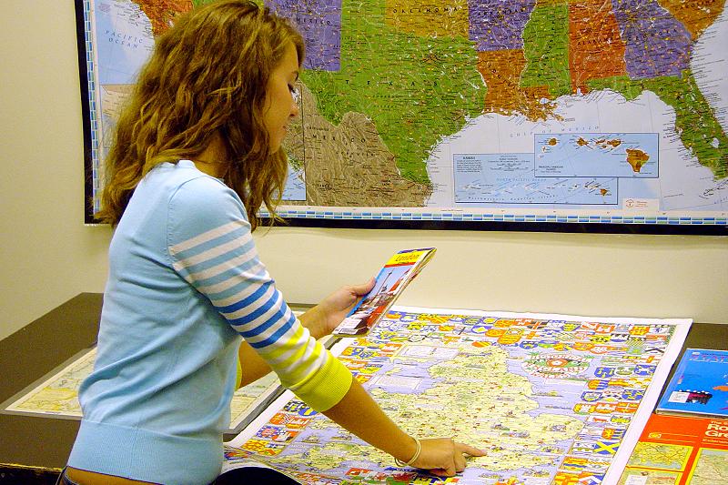
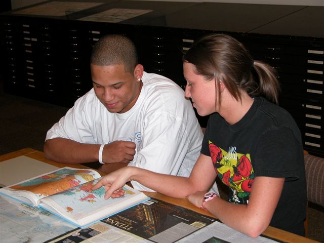
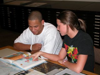
Classes of students ranging in age from elementary to elderly have visited the GCMC to utilize the extensive collection of maps, atlases, digital data, and GIS software. During the fall semester of 2005 and so far during the spring semester of 2006, dozens of classes have visited the GCMC to complement the learning environment in the classroom. For example, a class of sixth-grade students wanted to learn more about the different types of maps available and what types of information can be presented on maps and in atlases. These students were fascinated to learn about maps showing where diseases have spread across the globe, a map showing all the Major League Baseball stadiums, and especially the Titanic Reference Map. Three different classes of Landscape Architecture students visited the GCMC to learn about the resources available in preparation for a specific class project. Some students were preparing for a field trip to New York City while others were assigned a site to develop in Muncie. These students used various historic maps, street maps, atlases, aerial photography, and other data while working on their projects. The students working on the Muncie site checked out historical aerial photographs in five-year spans in order to focus on the changes in the city over time.

Other classes and instructors use the resources of the GCMC informally or individually for their classroom projects. Students in majors other than geography use the geographic resources available in the GCMC. Professors in Arabic, French, and German languages have borrowed maps for their classroom activities. A group of students studying anthropology once needed various types of data for an upcoming archaeological dig. Students who were studying sociology want to research the Amazon; Aquatic Biology thesis students need to look at topographic maps; students majoring in elementary and secondary education use maps and atlases for their lessons; many maps have been used as visual aids in a speech class; and Study Abroad students want to see where they are going. A cooking instructor at the Center for Vital Aging uses maps in her classes for the elderly to coordinate with the cuisine. Also, maps from the GCMC are featured on the WIPB Quiz Show on public television.

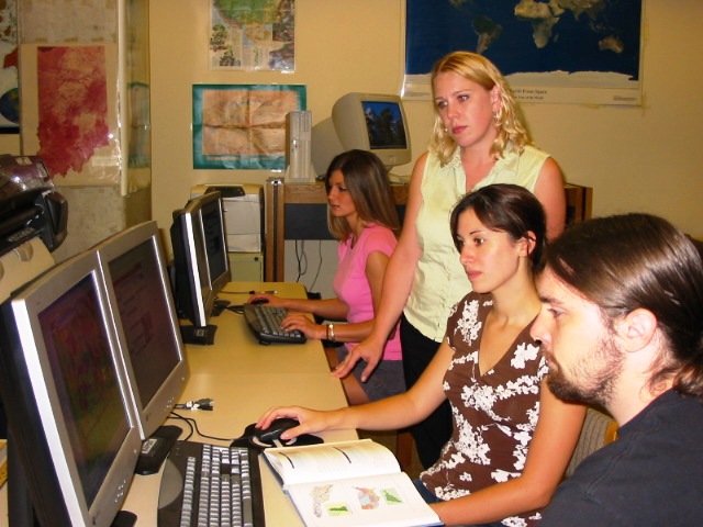
The GCMC also takes resources into the classroom for specific class needs. General GIS training sessions have been presented for students and faculty in English, Journalism, and Marketing classes. Students and Faculty in the Departments of Criminal Justice, History, and Environmental Management have also been exposed to GIS information during library instructional classes. Following their introduction to GIS principles, these students complete class projects using the geographic knowledge and skills they have gained. Many of these students then use the GIS lab in the GCMC to complete projects in other classes.

Classroom research and learning can be expanded with the resources of the University Libraries. The Geospatial Center and Map Collection is a great destination with a wealth of resources that can be used to enhance and elevate the classroom experience.

Tuesday, June 20, 2006