Friday, December 28, 2007

Color Printing at Ball State University Libraries

Color Printing at Ball State University Libraries

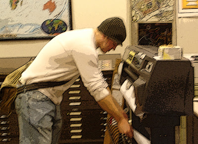
The Geospatial Resources & Map Collection has a large-format plotter available for anyone with a Ball State University account. The paper is 36 inches wide and prints copies as long as 108 inches. The charge for posters is $8 for the first 36 inches, $10 for prints from 37 to 72 inches, and $12 for prints from 73 to 108 inches. The charges are sent through the Bursar’s Office billing system.

Smaller color copies up to 11 by 17 inches can also be made at Bracken Library for 25 cents per page. From any computer in University Libraries, simply open the file menu and select “Print.” Use the drop-down box to select the color printer on 1 East or 1 West. Click either “OK’ or “Print” depending on the program. Type a name for the print job or select the option to use the file name and click “OK.” Pre-pay 25 cents per page at the selected printer, either with a copy card or with cash. Touch the “Mailbox” tab on the printer display. Touch the first box “BSU,” then select your print job from the list. Touch the “Print” button and “Start Print.”

Wireless laptop printing is also available in Bracken Library. To access this service, go to http://www.bsu.edu/libraries/laptopprint. Print jobs may be sent from the laptop to the Periodical/Reserve area of Bracken Library, the Architecture Library, Educational Resources Collections in Bracken Library, the Science-Health Science Library, and the first floor lobby of Bracken Library.

Maps in the News: Pakistan

Maps in the News: Pakistan

Pakistan is a country in turmoil. Benazir Bhutto, the Pakistani opposition leader and former prime minister, was assassinated Thursday as she left a political rally in Rawalpindi, Pakistan.

The Geospatial Resources & Map Collection is an excellent resource for information on Pakistan and other countries in the news. A variety of maps of Pakistan are available in the GRMC, including a map showing major ethnic groups, a tourist map of Pakistan, and a tectonic and geological map of Pakistan. The Central Intelligence Agency published a map of the political divisions of Pakistan, and another map shows the area of the border between Pakistan and Afghanistan. National Geographic published a map of Afghanistan and Pakistan, and a set of satellite image maps of Pakistan are also available in the Collection. Maps of cities in Pakistan include Rawalpindi, Islamabad, Lahore, Peshawar, and Karachi. Another map shows the Pashtun territory of Pakistan.

The Atlas Collection includes cultural, historical, and economic atlases of Pakistan. More information can be found about the country in atlases of India, the Middle East, and South Asia.

For more information about these resources, please contact the Geospatial Resources & Map Collection in Bracken Library.

Wednesday, December 26, 2007

Historic Atlas of Indiana Available at University Libraries

Rare Atlas of Indiana in University Libraries

Indiana was admitted to the Union on December 11, 1816, and six decades later the first important historical atlas of the state was published by Baskin, Forster, & Company in Chicago. The Illustrated Historical Atlas of the State of Indiana was created by Alfred T. Andreas in 1876. Copies of this invaluable resource are available as a reference item in the Geospatial Resources & Map Collection and Archives & Special Collections of University Libraries.

The atlas features 462 pages of maps of Indiana counties as they were divided in 1876. Each map includes the county seat, various townships, railroad lines, communities, churches, creeks and rivers, lakes, cemeteries, major landholders, and blacksmiths and other businesses. Colorful illustrations show courthouses and other government buildings, businesses, and private residences.

Maps of congressional, senatorial, and judicial districts of Indiana are included. Maps of the United States featuring various ethnic groups and agricultural production are featured in the front of the book. The atlas also includes thorough county histories, a business directory divided by county, and vital statistics for the United States in the back of the book. This informative atlas serves as a valuable resource for historians, historic preservationists, and genealogists.

For more information about this atlas, please contact the staff of the GRMC or Archives & Special Collections.

Maps of Toronto Available at University Libraries


GRMC Maps of Toronto for International Bowl

Ball State University’s football team will be representing the Mid-American Conference versus Rutgers University of the Big East Conference in the International Bowl in Toronto, Canada. The game will be played at noon on January 5, 2008, in Rogers Centre, formerly the Sky Dome.

Fans of the football team traveling to Toronto may wish to visit the Geospatial Resources & Map Collection to find maps of the city. The GRMC offers a variety of resources for fans traveling to Canada or for those interested in learning more about Toronto’s history.

The Collection includes two-2003 edition street maps of Toronto and the surrounding area, featuring inset maps of the downtown, driving distance charts, and toll and ferry information. An illustrated map of downtown Toronto from 2002 also features a map of the airport and subway system. A map of metropolitan parks of Toronto is available, as well as a port and harbor map of the city.

A great map for travelers is the imap of Toronto (shown above). The imap series of maps are laminated and include a working compass attached to the top of the map. This map displays tourist destinations, shopping centers, restaurants, and sporting venues.

Another map perfect for traveling is the Toronto EasyFinder map. This map is easy to handle and fold and extremely durable. The map features a map of downtown Toronto on one side and greater Toronto on the verso.

For those interested in learning about the history of Toronto, the Collection includes a bird’s-eye view map of Toronto from 1876. The Mapping of Victorian Toronto, Ontario’s History in Maps, and The Concise Historical Atlas of Canada are available in the Atlas Collection.

Maps may be borrowed from the GRMC for two weeks, while atlases check out for 28 days. For more information about these or any other resources, contact the GRMC in University Libraries at 765/285-1097.

Google Maps Street View of Indianapolis


Touring the Streets of Indianapolis with Google Maps

Google Maps has added Indianapolis, Indiana, and seven other cities to its “Street View” service, originally unveiled in June at http://maps.google.com/

Click on the left top tab marked “Street View” and click on the streets outlined in blue to view the new feature for Indianapolis. The service lets users explore 360-degree panoramic views of cityscapes and even some residential streets. The high-resolution photographic views are not live and were actually taken from vehicles driven along public streets within the last year. The images enable street-level tours so users can get a more realistic view of places researched on the maps site.

Holidays in the Geospatial Resources & Map Collection

Holidays in the GRMC

Winter and the season of holidays have officially arrived, and the Geospatial Resources & Map Collection offers a variety of materials for research, learning, and just for fun.

Winter recreation maps are available for Oregon, Maine, New Hampshire, Colorado, Montana, and the Adirondacks. The Collection includes maps of winter trails in national forests, cross country skiing maps, and downhill skiing maps, including resort maps of Aspen and Vail and regional skiing maps of Vermont.

Celebrate the holidays in the GRMC with maps of holidays in Switzerland, Santa Claus, Indiana, and North Pole, Alaska. The Collection includes a variety of maps of Bethlehem, including a bird’s-eye view of the old city and a guide, and numerous maps of the Holy Land.

The Geospatial Resources & Map Collection will be open Monday through Friday from 8:00 A.M. to 5:00 P.M. for the rest of semester break. The GRMC will close at 3:00 P.M. on Monday, December 31, and will be closed on New Year’s Day.

Friday, December 07, 2007

Mapping the Literary World Display at University Libraries


Mapping the Literary World Exhibit in Bracken Library

Mapping the Literary World, a special exhibit featuring maps and atlases related to literature, will be on display from December 3, 2007 through February 28, 2008 in the cases on the east side of the first floor of Bracken Library.

Students and faculty often use maps and atlases for research and learning or in the classroom for studying geography or even history. Maps can also be used for literary purposes. The University Libraries’ Geospatial Resources & Map Collection and the Atlas Collection include many maps and atlases that can be used in the study of English and literature.

Some of the maps on display feature famous authors from various states and countries or the poets and authors popular during a specific era of history like the Harlem Renaissance. Other maps depict the actual settings of popular works of literature like the Shakespeare’s Britain map. Still other maps and atlases display fictional places, like the maps of Narnia, Atlas of Middle Earth, Tolkien’s Beleriand, or Pooh Bear’s Hundred Aker Wood from the Atlas of Fantasy.

The display also features related works of literature and images from Archives & Special Collections.

Commemorative Pearl Harbor Map Available in the Geospatial Resources & Map Collection


Commemorative Map of Pearl Harbor in the Geospatial Resources & Map Collection


The Geospatial Resources & Map Collection includes a 60th anniversary map of the attack on Pearl Harbor from the National Geographic Society. This unique map provides a detailed overview of the events of December 7, 1941, and is available from the GRMC for research or classroom presentations.

The front of the map displays an aerial view of Battleship Row and the Navy Yard three days after the Japanese raid and details the damages to the individual ships with illustrations of squadron insignia in the margins. A bird’s eye-view of Oahu shows the first and second waves of the aircraft attack and paths over the Pacific Ocean of the Japanese strike force. The verso of the map is a reproduction of the Theater of War in the Pacific Ocean map, which was originally a supplement to the February 1942 issue of the National Geographic magazine.

Maps from the GRMC check out for two weeks. The GRMC is open Monday through Friday from 8:00 A.M. to 5:00 P.M.

Friday, November 30, 2007

University Libraries Hosts Visitors from China


Visitors from China in the Geospatial Resources & Map Collection

University Libraries and the Geospatial Resources & Map Collection hosted a group visiting Ball State University from China on November 30. The group consisted of officials affiliated with seven universities in China and the Sino-American University Cooperation and Exchange Office. The universities included Xi’an Shiyou University, Nanjing Normal University, Soochow (Suzhou) University, Shandong University at Weihai, Gansu Agricultural University, Inner Mongolia University of Technology, and Southwest Jiaotong University.

The visitors were thrilled to see so many maps of their hometowns and provinces in the Map Collection here at Bracken Library. The Collection includes new city maps, historic city plans, bird’s-eye-view maps of cities in China, topographic maps, and various thematic maps and atlases. Many of the maps and atlases from the Collection are printed in the Chinese language.

Ming-Ming Kuo, Collection Development Librarian, and Suzanne Rice, Assistant Dean for Public Services, organized and provided the tour of the University Libraries for the visitors.

Wednesday, November 21, 2007

Thanksgiving Break Hours in the GRMC


Thanksgiving Break Hours in the GRMC

The Geospatial Resources & Map Collection will be closing for Thanksgiving Break at 5:00 P.M. on Wednesday, November 21. The GRMC will reopen at 8:00 A.M. on Monday, November 26.

GIS Exhibit on the History of the White River


Online GIS Exhibit on the History of the White River

An exhibit showcasing the history of the White River in Muncie entitled, “The Life of a River: A History of the White River in Muncie in Maps and Photographs,” is now available:
http://www.bsu.edu/libraries/collections/gcmc/whiteriver/White%20River.html Users can also access the exhibit through the main GRMC Web page under “GIS Special Resources:” http://www.bsu.edu/library/collections/gcmc/


This exhibit was created by Angela Gibson, GIS Specialist, using a combination of historic maps from the Geospatial Resources & Map Collection, historic photographs from Archives and Special Collections and the latest GIS technologies available in the GRMC. The exhibit focuses on the changes that the river has experienced through time both culturally and physically. The GIS maps were created using a process known as geo-referencing (establishing the relationship between page coordinates on a planar map and known real-world coordinates) overlay and overlaying original historic maps from the GRMC with current GIS data to show the changing course of the river and the location of Delaware Indian settlements (above) and industries in relation to the current city geography.

The exhibit provides a remarkable resource for researchers, educators, and historians about the White River in east central Indiana. Contact Angela Gibson in the GRMC for more information about this exhibit and other GIS resources.

New GIS Resources at University Libraries


New GIS Resources Available in University Libraries’ Geospatial Resources and Map Collection

by Angela S. Gibson, GIS Specialist, Geospatial Resources & Map Collection

Ball State students and faculty now have new Geographic Information Systems (GIS) resources to use for learning, teaching and research through the University Libraries’ Geospatial Resources & Map Collection (GRMC).

Online Google Map for Visitors to the University Libraries

Angela Gibson, GIS Specialist, created an online visitors’ map of Ball State University that uses Google Maps API technology. Google Maps is a free Web mapping service application and technology provided by Google that powers many map-based services. The University Libraries’ Visitor Map is an added benefit to those visitors not familiar with Ball State University. The map highlights all library locations, parking garages, and food courts. Points of interest around campus such as Beneficence and Shafer Tower are also highlighted. Users are able to use the full range of Google technology such as pan and zoom, and have the option of street view, satellite view, or a hybrid of both. Images of each building and a link to their campus map Web page are embedded in the map. The Google map for visitors to University Libraries can be found at www.bsu.edu/library/collections/gcmc/visitormap

New Delaware County Oblique Photography

The GRMC now houses the complete set of Indiana’s Delaware County oblique aerial photography. The Delaware County GIS office donated a copy of the photography to the GRMC for University and community use.

Oblique photography is the technical term used to describe an aerial photograph that is taken at an angle. A feature such as a house, a building, or an overpass can be seen in its entirety. You can rotate the image and see the front door, the back door and both sides as well. This viewpoint is more familiar to users and provides almost instant 3-D modeling. These datasets are available for use by anyone inside or outside of the University. The datasets can be used by students and faculty who are working on surveying, 3-D modeling, and landscaping and urban planning projects. Geographic data and 3-D models from this program can be imported into Google Map for further analysis and sharing of data.

BusinessMAP Software by ESRI

BusinessMAP 4.5 is now available in the GRMC for students and faculty. This powerful GIS software prepackages North American street and zip code data, demographic data, Dun & Bradstreet business listings, contact manager links (ACT!, GoldMine, Outlook/BCM,
and Excel), and many other resources for analysis via GIS. Users can easily create reports, charts and maps of their study area. They can also do drive-time analysis and ring study analysis of their project site. This software is especially useful for anyone interested in marketing or demographic analysis. To test or use the software, visit the Geospatial Resources & Map Collection on the second floor of Bracken Library.

For more information on these new resources or any other GIS applications, contact Angela S. Gibson, GIS Specialist.

Tuesday, November 13, 2007

University Libraries Celebrates GIS Day, November 14

University Libraries Celebrates GIS Day

GIS Day is being celebrated nationwide on Wednesday, November 14. GIS is a “collection of computer hardware, software, and geographic data for capturing, managing, analyzing, and displaying all forms of geographically referenced information.” This is the definition of GIS according to ESRI, an annual sponsor of GIS Day.

University Libraries will be celebrating GIS Day in the Geospatial Resources & Map Collection on Wednesday from 9:00 A.M. to 3:00 P.M. Visitors can try out new GIS software including BusinessMap 4.5, see online maps created with Google Maps API, view the Delaware County Oblique Photography, and explore online exhibits using GIS technology. Angela Gibson, GIS Specialist, will be available to demonstrate the new technology and provide more information about using GIS for applications in almost every discipline and field.

The annual GIS open house sponsored by the Geography Department and the Office of Wireless Research and Mapping will also be held on Wednesday in Cooper Life 469.

Geography Awareness Week, November 11-17


Geography Awareness Week: Passport to Asia

November 11 -17 is Geography Awareness Week. National Geographic has been celebrating Geography Awareness Week since 1987, and this year’s theme is Passport to Asia. The Geospatial Resources & Map Collection has a variety of resources featuring Asia.

New maps of China, Kazakhstan, Kyrgyzstan, Tajikistan, Turkmenistan, and Uzbekistan are available in the GRMC. Maps of Myanmar (Burma) and Thailand were also recently acquired. Maps of East Timor, Asia’s newest country, are also available from the GRMC. A tourist map of Phuket and southern Thailand features places of interest, and the Streetwise Tokyo map displays current tourist destinations. New tourist maps of Hong Kong and Singapore are also available for checkout, as well as city plans of Sri Lanka and China.

The Atlas Collection houses a large collection of recent atlases of Asia. The State of China Atlas: Mapping the World’s Fastest Growing Economy offers a variety of maps about different topics in China. Researchers of history will be interested to find historical atlases of Pakistan, Iran, Afghanistan, Saudi Arabia, and Central Asia. The Atlas of Asian-American History is another excellent resource for historians available in the Atlas Collection. The East Sea in Old Western Maps features maps of the sea located between Japan and the Korean peninsula.

Contact the staff of the Geospatial Resources & Map Collection for more information about these resources or any other questions at (765) 285-1097.

Monday, November 12, 2007

University Libraries Hosts International Festival

University Libraries Welcomes the World with International Festival

The annual Rinker Center for International Programs’ International Festival was held in the lobby of Bracken Library on Friday, November 10. The festival featured booths representing over thirty countries from around the world. (Ball State University is home to international students from 91 countries).

Students shared information about their home countries, displaying artifacts, artwork, maps, photographs, food and drinks. Music from around the world played throughout the festival, and a fashion show exhibited the beautiful clothing worn across the globe.

The Geospatial Resources & Map Collection provided maps used during the festival. Displays featured maps of Africa, Iceland, Germany, France, and the Netherlands from the Map Collection. “The Americas” section of the festival used several maps from the GRMC for their display. Maps of all of Latin America, South America, the Caribbean, Colombia, Uruguay, and the Amazon rainforest were featured for the festival. Many of the international students were surprised to find a map of their hometown in the GRMC.

University Libraries is a great destination for international resources. In addition to the thousands of maps and atlases in the GRMC and Atlas Collection, researchers can explore the Educational Resources Collections’ variety of materials to support learning about cultures, including videos, pictures, artifacts, flags, globes, kits, international dolls, musical instruments, realia and more.

Find international music resources using the “World Music” Media Finder on the University Libraries’ Web site. This media finder will locate CD’s, books, scores and thousands of titles and artists featuring music from all over the world.

Rare books, art books, copies of The Bible and great works of fiction and poetry can be found in many different languages in the Archives & Special Collections. Pamphlets from the French Revolution, Nazi atlases, brochures, and books, and many other materials are located in the Archives, and historic photographs, speeches, magazines, films, and oral histories are available on the Digital Media Repository on the University Libraries’ Web site.

The Digital Media Repository also includes images from the Architecture Library’s Visual Resources Collection. High quality images of architecture from around the world are featured, along with photographs taken during the World Tour and CAPAsia trip. The Architecture Library also includes books on international architecture, landscape architecture, and urban planning.

Visit the University Libraries’ Web site located at www.bsu.edu/library/
for more information about international resources available from this great destination for research and learning.

Wednesday, November 07, 2007

New and Notable in the GRMC, October 2007

New and Notable in the GRMC, October 2007

The Geospatial Resources & Map Collection hosted many different classes during the month of October. Over 130 students from Social Studies Methods, History, Education Library, and English attended instructional sessions learning about maps and atlases and GIS resources in the GRMC.

Students working on class projects also used the resources of the GRMC during October. Architecture students working on a project in Cincinnati borrowed historic and current maps for their work. Students in landscape architecture are planning an urban park in downtown Muncie, so they visited the GRMC to borrow maps and to collect GIS data. Other landscape architecture students studied historic maps of Muncie to learn about the location of streetcar lines, and historic preservation students used maps and atlases of New Albany for an upcoming project. The GIS Specialist created custom maps using data and resources for students in urban planning, foundations of education, and journalism. A professor of language and linguistics acquired GIS maps for a project on Mexican-Indian dialects in Mexico. And a professor in natural resources is using physical maps of Australia from the GRMC in his classroom for a special project.

The GIS lab received updated software during the month of October. Oblique aerial photography of Delaware County was installed on the GIS lab computers, and ESRI BusinessMap 4.5 software was also added to the lab.

The GRMC Web site was also updated with a third online map tutorial, Using Maps and Atlases in Social Studies Lessons. This tutorial explains how K-12 teachers can teach lessons about a large variety of topics by featuring images and information from maps and atlases. The tutorial is located under the “Maps and Atlases” section of the GRMC Web site at http://www.bsu.edu/library/collections/gcmc/

Tuesday, November 06, 2007

International Festival at University Libraries


International Festival at University Libraries

The Rinker Center for International Programs is sponsoring the annual International Festival on Friday, November 9 in the lobby of Bracken Library from 9:00 to 4:00 P.M.

The International Festival features over twenty booths displaying food, music, clothing, maps, and cultural artifacts from around the world. Visitors can explore the displays about various countries and groups, taste the different foods, listen to music, and mingle with students from around the world.

A special display will feature international resources available from University Libraries, including maps, international music, flags, globes, videos and foreign films, photographs, realia, kits, and more. International resources are available from the Educational Resources Collections, the Geospatial Resources & Map Collection, the Music Collection and Music Listening Center, Archives and Special Collections, and the Architecture Library. Many of the University Libraries’ international resources are available from the Digital Media Repository located at http://libx.bsu.edu/

Admission is free to the International Festival. For more information, contact Debra Goens at the Rinker Center for International Programs.

Host of National Geographic "Explorer" Visits Ball State University

National Geographic "Explorer" Host Lisa Ling to Speak at Ball State University

National Geographic’s Geography Awareness Week is November 11-17, but the celebration of geography begins early this year as Ball State University welcomes Lisa Ling, host of National Geographic “Explorer.” Ling will be a guest lecturer at the Pittenger Student Center Cardinal Hall at 7:00 P.M. on Thursday, November 8.

Ling will present “National Geographic Reports: A Global Perspective,” in which she will discuss issues impacting our world and solutions for helping those in need. Ling will feature video clips from her television program, “Explorer,” and there will be a short question-and-answer session and meet-and-greet following the presentation.

Ling’s lecture is sponsored by Excellence in Leadership, Asian American Student Association, Housing and Residence Life, the Multicultural Center, and the Department of Telecommunications. The event is free and open to the public.

Tuesday, October 30, 2007

Festival of Maps Chicago Begins November 2


Festival of Maps Chicago Begins November 2


November 2 is the official opening of The Festival of Maps Chicago. According to the website overview, “The Festival of Maps Chicago is a citywide celebration that joins over 30 cultural and scientific institutions in a unique collaboration to display humanity’s greatest discoveries and the maps that record our boldest explorations.” The festival features globes, artifacts, artwork, and hundreds of unique maps, including the map Charles Lindbergh carried with him on the first nonstop solo flight from New York to Paris in 1927.

The participating institutions include the University of Chicago Special Collections Research Center, The Art Institute of Chicago, the Chicago History Museum, the Museum of Science and Industry, the Brookfield Zoo, and the Newberry Library. The Festival of Maps Chicago includes amazing exhibits, lectures, seminars, and films.

The Festival of Maps Chicago runs through January 31, 2008. For more information, visit http://www.festivalofmaps.com/

Wednesday, October 24, 2007

New Maps in the Geospatial Resources & Map Collection


Weekend Excursions Using New Maps from the GRMC


Autumn is a great time to pack up a picnic basket and take a weekend excursion to southern Indiana. The Geospatial Resources & Map Collection recently acquired new maps that may help with planning the perfect weekend adventure.

The Indiana Wine Trail: Down the Lazy River, Southeast Indiana map suggests “kicking back to enjoy a leisurely drive, stopping along the way to discover the quaint charm of the region and visit six artisan wineries.” Swiss immigrants planted vineyards near Vevay two hundred years ago to produce America’s first commercial wines. Now travelers can explore this wine trail to sample a taste of that history. The wineries located on this trail are located in Guilford, Batesville, Madison, and Vevay.

Indiana Uplands Wine Trail map features wineries located in south central Indiana. These wineries include the popular Oliver Winery in Bloomington, the Butler Winery and Vineyard in Bloomington, the Carousel Winery in Bedford, the French Lick Winery, the Winzerwald Winery in Bristow, Turtle Run Winery in Corydon, and Huber’s Orchard and Winery in Starlight. The map suggests travelers on this trail stretch their tour over two days—one for the northern section and one for the southern section.

Another map recently acquired by the GRMC is called Wineries of Indiana. This map includes 40 wineries located all over the state—from Whiting over to Rockville down to Evansville and east over to Modoc. The map claims “wineries offer close to home adventures with an educational flare.” More information is available at http://www.indianawines.org/

These maps were a generous gift from Jacqueline Luzar, Ball State University alumnus.

Maps in the GRMC check out for two weeks. Contact the staff for more information.

Wednesday, October 17, 2007

World War II Display in Bracken Library

World War II Display in University Libraries

The exhibit, Shared Sacrifice: Scholars, Soldiers, and World War II, will be on display from October 15, 2007 through January 4, 2008 outside the University Libraries’ Archives and Special Collections and the Geospatial Resources & Map Collection on the second floor of Bracken Library.

This exhibit will focus on Ball State University’s contributions to the war effort, soldiers from Muncie, and life on the home front, as well as additional resources found in the Archives and the Geospatial Resources and Map Collection. Ball State’s contribution will be documented through photographs from the Army Specialized Training Program. The activities of Muncie’s soldiers will be shown through photographs, letters, and other ephemera from former Dean Victor Lawhead’s papers and Joseph Fisher’s scrapbook, as well as books featuring the recollections of local soldiers. The home front section of the exhibit will contain ration books, Red Cross materials, newspapers, and government publications. An additional feature of this exhibit will be World War II resources such as items from the Nazi Collection and the 376th Bombardment Group Archive, as well as other printed materials and wartime maps.

Maps and photographs featured in atlases about World War II are featured in a special display on the windows of the GRMC. Authentic wartime news maps created for the Armed Forces are also included, along with Army Map Service maps of France, wartime newspaper maps from the Chicago Tribune, and a nautical chart of Nantucket Island that was used by the Nazis during the war.

An online exhibit will also be available later in the month at www.bsu.edu/library/collections/archives/exhibits.


Tuesday, October 16, 2007

Indiana October Festivals Map in the GRMC


Fall Festivals Map in the Geospatial Resources & Map Collection

Amber Lukes, student assistant in the Geospatial Resources & Map Collection, created a special display of fall festivals for the month of October. Amber chose some of the most popular fall celebrations for the special Indiana map. The map includes classic fall festivals like the Parke County Covered Bridge Festival, the Riley Festival in Greenfield, and the Feast of the Hunter’s Moon in Lafayette. The map also includes activities for Halloween like the Headless Horseman at Conner Prairie in Fishers.

Amber is a senior and has worked in the GRMC since January. She is majoring in residential property management.

Vera Bradley GIS Project in the GRMC

Vera Bradley GIS Project in the Geospatial Resources & Map Collection

Students at Ball State are taking advantage of an exciting immersive learning experience with Vera Bradley Designs, Inc., an internationally-known company based in Fort Wayne, Indiana. In two classes at the Miller College of Business, Dr. Rod Davis and Dr. Jennifer Bott are instructing a cohort of 15 students to work with Vera Bradley Designs representatives to design roll-out plans for a signature store grand opening in three new markets. Faculty at the Miller College of Business concluded that working with Vera Bradley Designs would be a great immersive learning experience for their students.

The class is working in three groups of five students. Each team will focus on a particular city and will determine the best way to identify information about competitors and cities. The assignment requires the students to create a city report, company report, team report, and a presentation, among other outcomes. Students will research the company and the market, and perform a strategic planning analysis, known as a Strengths-Weaknesses-Opportunities-Threats (SWOT) analysis. During a class presentation, Stephen K. Duecker, Information Services Librarian, identified five databases that the students would find useful in their research. Angela S. Gibson, GIS Specialist, also gave a brief presentation to the class regarding the capabilities of GIS and how incorporating demographic GIS data and maps into their research would greatly benefit their project.

Dr. Davis and Angela then met to decide the best way to use GIS for both the students’ self-learning and achieving the project goals. A portion of the project’s grant money was set aside to buy trial licenses of ESRI’s Business Analyst Online, a software package which combines GIS technology with demographic, consumer, and business data to deliver on-demand analysis, graphic reports, and maps over the Web.

Students from this class are also visiting the GRMC to map potential business competitors. To do this,
Angela is using a feature called geo-coding in the ArcGIS software. Dr. Davis said, “The Libraries’ instruction session helped students to identify avenues for information. Students did a good job finding data and understanding what is available.” Commenting on the immersive learning experience, Dr. Davis said, “The students are able to apply what is being taught in their classes to real life experiences. They realize this is not your typical class."

For more information about using GIS in a classroom project, contact the Geospatial Resources & Map Collection staff.

Friday, October 05, 2007

New South Wales Topographic Maps in the GRMC


Geospatial Resources & Map Collection: Maps from Down Under


The Geospatial Resources & Map Collection purchased a set of topographic maps of New South Wales, Australia. The maps were acquired from the Department of Lands in New South Wales. The maps feature topography on one side and aerial photography of the area from 2002 on the verso, and the scale is 1:25,000.

The location of these maps is concentrated around the area of the Ball State University Australia Center in Lennox Head. Last summer the Australia Center Director Paul Wohlt (Assistant Professor in Anthropology) requested the maps for use in Australia for the fall semester. Students from Ball State University used the maps in the classroom and for field work during their time in Lennox Head.

These topographic maps/aerial photographs are available for checkout from the GRMC. The maps circulate for two weeks.

The GRMC encourages recommendations for purchase of maps and atlases needed for research and learning. Please contact the GRMC for more information.

Thursday, October 04, 2007

Guided Tours of Christy Woods at Ball State University

Fall Tree Walks at Christy Woods

The Ball State University Field Station & Environmental Education Center is hosting guided tours of the trees in Christy Woods. The Fall Tree Walks at Christy Woods are held each Saturday in October at 1:00 P.M. Field Station & Environmental Land Manager John Taylor serves as the guide for the tours. The tours meet outside the Orchid Greenhouse and last about 45 minutes, and admission is free and open to the public. Parking is available along Riverside Avenue and in lot G13, south of the Orchid Greenhouse on University Avenue just west of West Quad.

Wednesday, October 03, 2007

September 2007 GRMC Events

What’s Happening in the GRMC? September 2007 Edition

The Geospatial Resources & Map Collection served as a second classroom during the month of September. Many different classes visited the GRMC for instructional sessions and tours, including English, Teachers of English to Students of Other Languages, and Foundations of Education.

Students from the College of Architecture & Planning also used the resources of the GRMC for special classroom projects. Landscape Architecture students working on a regional planning project of the White River borrowed maps showing vegetation, soils, recreational areas, transportation, and wildlife. The students were also able to access digital data and custom maps in the GIS lab in the GRMC.

Jay County High School students enrolled in English 103 used maps from countries all over the world to create culture packets for a class assignment. Anthropology students used maps and atlases of Africa for a research presentation. Biology students borrowed ecological maps of the Mississippi Delta for use in their classroom. And elementary education students used maps of Sweden and Scotland for special lessons.

A professor of Language and Linguistics was able to have custom maps of areas of Mexico created using the GIS lab. The maps showed areas where Mexican-Indiana dialects are spoken. Students working on an immersive learning project were able to access census data and have custom maps created in the GIS lab.

The resources of the GRMC were also used for recreational purposes during September. Two students planning a trip down the Mississippi River reviewed topographic maps and atlases to review the course of the trip. And topographic maps of an obscure wilderness area in Canada were used by another visitor planning a fishing expedition.

Visit the GRMC on the second floor of Bracken Library for resources for the classroom, for research projects, and for recreational excursions--for fun!

GRMC Website Features Online Map Tutorials

Learning about Maps: Online Map Tutorials from the GRMC

Interested in learning about the basic parts of maps? Need to brush up on some geographic skills? The main Website for the Geospatial Resources & Map Collection has added a new feature: custom map tutorials.

Users wishing to learn about maps can now access the site at their own convenience. The first tutorials are from a developing series on maps and cartography. The Elements of a Map is a tutorial that teaches about the main geographic features found on every map, like legend, scale, and directional indicators. The tutorial features colorful examples of elements of maps from the Map Collection. The second tutorial Topographic Maps teaches users how to read topographic maps and how the maps are used in industry and development projects. Teachers of geography and other subjects are encouraged to use the tutorials in their classroom or for review purposes with their students.

These online resources are available under the Maps and Atlases section of the main GRMC page located at http://www.bsu.edu/library/collections/gcmc/ After completing the tutorials, users are asked to provide feedback, including suggestions for topics of future tutorials. Please contact the GRMC to suggest subjects for other online tutorials or with any questions regarding their use.

Friday, September 28, 2007

Department of Natural Resources Web Site Resources


Autumn in Indiana via Cyberspace


Sunday, September 23, marked the first day of autumn in Indiana, so soon the beautiful changing colors of the trees will mark the season. The Department of Natural Resources has posted a “Leaf Cam” on its Web site. The “Leaf Cam” shoots still photographs of various forested sites around Indiana and refreshes every 15 minutes. Viewers can watch for the peak color changes of fall in the coming weeks. The locations of the cameras are Hilltop Cabins in Brown County, Conner Prairie in Noblesville, French Lick Resort, The Fort Golf Course in Lawrence, Lafayette Municipal Golf Course, and Spring Mill State Park.

The Web site is cosponsored by the Indiana Office of Tourism Development and also features an interactive travel guide, listing campgrounds, festivals, restaurants, contests, and other information. Interactive maps of Indiana are also available on the site.

The main Web site is located at http://www.in.gov/visitindiana/ and the “Leaf Cam” is located at http://www.in.gov/visitindiana/leafcam/

Thursday, September 27, 2007

Maps in the News: Iran


Maps in the News: Iran

The visit of President Mahmoud Ahmadinejad to the United Nations and Columbia University in New York this week once again placed Iran in the world news headlines. The Geospatial Resources & Map Collection is an excellent source for maps and atlases featuring countries all over the world, and the Collection includes a wide variety of maps of Iran.

One of the newest maps of Iran in the Map Collection is the Iran Country Profile created by the United States Central Intelligence Agency. This map features a large map of the country with inset maps showing regional physiography, ethnoreligious distribution, population density, key petroleum sector facilities, energy prospects, and a comparative map. The comparative map displays Iran stretching from South Dakota over to Michigan and down to Georgia as an overlay of a map of the United States.

Another map, Tourist Guide to Iran and Tehran, features popular attractions in the country and its capital city. The map gives information about the topography, the seas, the flora and fauna, government, climate, and population and cultural features. The map of Tehran (above) shows the locations of museums, schools, palaces, and other attractions. Images on the map (above) show amusement parks and sports stadiums.

Other geographic resources about Iran in the Collection include a map of mineral deposits in the country, a natural vegetation map, a map about a festival in Guilan Province, and maps of Abadan, Qum, Yazd, and other cities and provinces in Iran. Atlas d’Iran, Atlas of Iran White Revolution, and A Historical Atlas of Iran are also available in the Atlas Collection.

Maps from the GRMC check out for two weeks, and atlases check out for 28 days.

Contact the GRMC for more information about resources on Iran for research and learning.

Friday, September 07, 2007

New York Photo Atlas Available from University Libraries

Aerial Images of New York in the Atlas Collection

Tuesday marks the sixth anniversary of the September 11th terrorist attacks on the United States. This aerial image of lower Manhattan shows the former site of the World Trade Center as it appeared in 2004. This aerial photograph is taken from New York: The Photo Atlas: An Aerial Tour of All Five Boroughs and More, which is available for checkout from the University Libraries Atlas Collection.

The Atlas Collection is located on the east side of the second floor of Bracken Library. The staff of the Geospatial Resources & Map Collection can help locate any atlases needed for research and learning. Atlases check out for four weeks.

Top Ten Reasons to Visit the GRMC


In honor of the David Letterman dedication ceremony at Ball State University on September 7...


Tuesday, September 04, 2007

September 2007 Map Display

September 2007 Map of the Month

The “Map of the Month” for September in the Geospatial Resources & Map Collection is called Che’s Route: Ernesto Guevara’s Trip across South America. The map marks the travels of political figure and revolutionary Ernesto Guevara, more commonly known as “Che.” The map traces the route of Guevara’s 1952 motorcycle trip across the continent, and includes descriptions of every major stop in Argentina, Peru, Chile’, Colombia, Venezuela, and Bolivia.

September 15 is the beginning of Hispanic Heritage Month, which marks the independence of five Latin American countries. Many believe that Guevara was responsible for the revolutions for independence of many of these countries.

Visit the GRMC for more information about this map or any other geographic resources.

August 2007 Events in the GRMC

What's Happening in the GRMC? August 2007 Edition

August is the time for back-to-school at Ball State University, and classes have already begun visiting the Geospatial Resources & Map Collection for instructional sessions and various research projects.

Elizabeth Nesbitt, an instructor for the Writing Program in the Department of English, brought three sections of her English 102 and 104 classes into the GRMC for customized instructional sessions during the month of August. Students were given an assignment using maps for rhetorical analysis. Students viewed maps of the same place from two different perspectives and maps created from an unusual point of view. Students learned about the visual information provided by how maps are created and how various topics are represented on maps. Students then chose five maps of different topics and learned how to cite the maps and atlases.

Students in Marketing & Management 300 also learned about the resources of the GRMC in their classroom. Digital national base and census data and GIS applications were presented to enhance a class project in coordination with Vera Bradley Retail Stores, Inc. Students in Natural Resources & Environmental Management also learned about GIS resources available in the University Libraries.

Geography and Political Science students will be using maps from the GRMC in their classroom for special research projects throughout the fall semester. Many other students have already begun using the GRMC for their research and learning. Students from anthropology, geology, social studies, and the College of Architecture & Planning visited the GRMC during the month of August. Even an instructor for a cooking seminar used maps from the GRMC for an upcoming lesson.

The Geospatial Resources & Map Collection is a great destination for research and learning. Contact the staff for more information about customized instructional sessions in the GRMC.

Friday, August 31, 2007

GRMC Holiday Hours


Geospatial Resources & Map Collection Holiday Hours

The Geospatial Resources & Map Collection will be closed for Labor Day on Monday, September 3. The GRMC will reopen at 8:00 A.M. on Tuesday, September 4.

Wednesday, August 29, 2007

Electronic Resources Available in GRMC

More than Maps in the Geospatial Resources & Map Collection

The Geospatial Resources & Map Collection in Bracken Library houses thousands of maps and atlases and includes a GIS lab with access to useful geographic data and the latest computer software, but other electronic resources are also available in the GRMC. The GRMC includes a collection of over 250 CD-ROM’s featuring geographic and mapping software.

National Geographic’s Back Roads Explorer 3-D is available in the GRMC. It features topographic maps with updated roads for all fifty states. Users can pan, zoom, and customize a route along one or more maps and see the animated 3-D preview. The software also allows the creation of elevation profiles and printing custom maps.

Delorme’s Topo USA is a similar mapping software that includes topographic coverage of United States. Users can search locations, view street-level detail, calculate routes, view 2-D and 3-D terrain with shaded relief and 20-foot contour intervals, and view land cover features and elevation profiles. The software includes draw and print tools for customizing and printing. The software can also be used to download maps and route directions to Palm OS handheld devices and use the Global Positioning System (GPS) through a connection with a GPS receiver.

The GRMC also includes computer software from TIGER/line featuring digital databases of geographic features. The U.S. Geological Survey published computer software featuring digital raster graphic data from various areas around the United States. A Topographic Field Trip of Washington, D.C. is another CD-ROM from the U.S.G.S. The Collection also includes weather charts from the National Imagery and Mapping Agency, Congressional District Atlases, Census tract outline maps, and Census block maps. Gap analysis GIS data for the United States is also available as an electronic resource in the GRMC.

The AniMap Plus: County Boundary Historical Atlas CD-ROM available in the GRMC displays over 2,000 maps showing all the changing county boundaries in the 48 adjacent states for every year from colonial times to the present. It also includes searchable databases containing more than 240,000 cities, towns and other populated places, over 30,000 historical sites, and 100,000 cemeteries, all of which can be plotted on the maps. This software enables users to locate historical towns which are not on current maps or which are now in a different county.

The GRMC also includes a CD-ROM of the Historic Atlas of Indiana Counties from 1876. The CD-ROM consists of high resolution digital maps in Adobe (PDF) portable document format. Each map includes the following 19th century features: roads, railroads and canals; cities, towns and villages; post offices and government sites; one-room schoolhouses, churches and cemeteries; rivers, streams and ferries; racetracks, fairgrounds and picnic groves; industrial sites, furnaces and mills; and early homesteads and farms.

Some of compact discs in the GRMC are available for use in the GIS lab, but some also circulate for two weeks. For more information about the collection of computer software in the GRMC, contact the staff Monday through Friday from 8:00 A.M. to 5:00 P.M.

Monday, August 27, 2007

ESRI GIS Movie Presentation

Everyday GIS

ESRI developed a movie presentation about how GIS is a part of our lives every hour of every day. The presentation features examples of GIS maps and applications at http://www.esri.com/company/gis_touches/everyday.html

The Geospatial Resources & Map Collection features a GIS lab with dual monitors, and a GIS Specialist is available to assist with projects and data retrieval. The GRMC is open Monday through Friday from 8:00 A.M. to 5:00 P.M.

Thursday, August 16, 2007

GRMC an Extension of the Classroom

Back to School in the Geospatial Resources & Map Collection

Classes at Ball State University begin on Monday, August 20, and faculty members are encouraged to extend classroom learning and research to the Geospatial Resources & Map Collection. The GRMC will create an instruction session tailored to the needs of your students on such topics as finding and using maps, types of maps and their use, sources for locating geospatial data, and tools for researching geographical information.

Class assignments requiring the use of the GRMC or any part of its resources are encouraged. The GIS Specialist can show students how to use GIS and geographic data in special projects in the GIS lab. Materials from the Collection may be used in a special study area of the GRMC, and faculty may reserve maps when an entire class will be using the materials.

Lessons using specific resources from the Collection (such as Civil War maps, historical atlases, or Indiana county soil surveys) may also be coordinated with faculty classroom projects. View the presentation "Using Maps and GIS in Social Studies Lessons" created for the SS392 Social Studies Methods class, June 2007.

Orientation tours of the GRMC for school and community groups may also be arranged. Small-group presentations can also be accommodated.

Individual students may find many resources available in the GRMC. Students writing research papers may wish to borrow or scan a map or part of an atlas to add to their paper. And students presenting speeches may wish to borrow a map as a visual aid. The Collection includes many poster-type maps that cover special interest topics like environmental issues, dinosaurs of North America, endangered species, world terrorism, the Harlem Renaissance, soccer around the world, and even the route of the Titanic.

If you are a faculty member and would like to schedule a library instruction session for your class, please contact the GRMC staff. The GRMC is open Monday through Friday from 8:00 A.M. to 5:00 P.M.

Thursday, August 02, 2007

GIS and Football in the GRMC


GIS for Game Day: Ball State University Football Map

Football season officially begins today at Ball State University with the first practice of the year. Assistant Coach Eddie Faulkner greets his running backs each season with a large poster showing where the players live. The GIS Specialist in the Geospatial Resources & Map Collection Angela Gibson created this map for Coach Faulkner using GIS software. The map was then printed on the large-format plotter in the GRMC for display in the football office.

Contact the GRMC to inquire about the creation of custom GIS maps for special research projects or to print a poster on the large-format plotter. Charges for printing are sent directly to the Bursar’s office.

Topographic Maps from around the World in GRMC

Topographic Maps from Around the World Available in GRMC

The U.S. Geological Survey topographic quadrangle maps are popular items in the Geospatial Resources & Map Collection, but what if someone needs a topographic map of Iceland for research or learning? The GRMC has that, too! There are actually five different sets of topographic maps of Iceland created at different scales in the Collection. In fact the GRMC has individual topographic maps from over fifty countries around the world, including Brazil, Guyana, Poland (shown), Brunei, Mongolia, Madagascar, Senegal, and Pacific Island countries.

World and regional topographic map sets cover literally the rest of the world. World topographic maps are available in many different scales. Regional topographic maps cover areas of different countries. These topographic maps cover regions of South America, Europe, Asia, and Africa. And topographic maps of Antarctica are even available from the Collection.

Topographic maps are important tools in geographic research because they are created using contour lines, showing areas of equal elevation. These maps make it possible to measure the terrain of the countryside or the height of mountains. Architecture students find the maps useful for site planning.

All the maps in the GRMC circulate for two weeks. Please note that not all of the topographic maps are cataloged in the library CardCat system, so contact or visit the GRMC to find out what types of maps are available for specific areas around the world.

The GRMC is open during the summer Monday through Friday from 7:30 A.M. to 4:30 P.M. and during the academic year from 8:00 A.M. through 5:00 P.M.

Wednesday, August 01, 2007

Indiana Higher Education Map Display

Happy Meals, Heismans, and Higher Education:
Indiana Back-to-School Facts Map Display


A special “back-to-school” map display for August was created by the Geospatial Resources & Map Collection student-assistant Amanda Hunt. Amanda’s actual work-home at University Libraries is in the Archives & Special Collections, but she is also working in the GRMC for the summer.

Amanda is a junior from Vincennes, Indiana, where she graduated from Vincennes Lincoln High School. Majoring in history with a French minor, Amanda plans to attend graduate school for library science and/or history in order to become an archivist. Her dream job would be working as an archivist at a large or medium-size museum.

Amanda compiled a list of interesting facts about some of the colleges and universities in Indiana in order to create this map of “fun facts.” Some surprising facts on the map: Manchester College is the home of the first peace studies program in the United States; the President of Starbucks attended DePauw University; Notre Dame produced seven Heisman Trophy winners; and Carter’s Hot Dogs in Ball State’s Village was voted #51 on the Sports Illustrated “On-Campus Top 100 Things You Must Do before You Graduate.”

Visit the east side of the second floor of Bracken Library to view this and other map displays.

Ball State University Campus Maps Display


Ball State University Campus Maps through the Ages

The map featured is a campus map of Ball State University from 1929. The school had just received its new name Ball State Teachers College during that year. This map is one of the maps featured in the “Map of the Month” display in the Geospatial Resources & Map Collection on the second floor of Bracken Library. This special “back-to-school” display features maps dating from 1928 to 1996. The changes in the landscape of the campus from the beginning and since 1996 are striking.

Contact the GRMC for more information about these historic maps of Ball State University.

Tuesday, July 31, 2007

Recreational Maps Artwork Display


Summer Fun Displayed on Recreation Maps

Click to view the special summer map display featuring artwork from recreational maps in the Geospatial Resources & Map Collection.

New Orleans Map Acquisitions in the GRMC

New Materials in the GRMC for Hurricane Katrina Research

August marks the two-year anniversary of Hurricane Katrina. The hurricane formed on August 23, 2005, and devastated the Gulf Coast and New Orleans by August 29. Hurricane Katrina was the costliest and one of the deadliest hurricanes ever in recorded history.

The Geospatial Resources & Map Collection has added two maps related to Hurricane Katrina to the Collection. The U.S. Geological Survey created a map showing the water depth of Hurricane Katrina in New Orleans. The map was produced using remote sensing data. According to the map vendor Terra Prints, “Because an accurate delineation of the flooded area was not yet available, the flood water level within the city was derived from a lake level gage on Lake Pontchartrain, with the assumption that the level of the lake and the floodwaters had equalized by Friday, September 2, 2005.”

The second map is a satellite wall map of New Orleans, Louisiana (shown above). This map of New Orleans was acquired via satellite in 2000 prior to the devastation of Hurricane Katrina. Lake Pontchartrain borders the city to the north, and the Mississippi River winds its way through the image.

Both of the maps will be available for checkout in the GRMC. Be sure to check the map exhibit of Historic Hurricanes displayed in the front window of the GRMC on the second floor of Bracken Library.

Friday, July 20, 2007

Scanner Available in the GRMC

Scanning in the GRMC

The Geospatial Resources & Map Collection offers a scanner for use digitizing maps and atlases from the Collection. This service is especially convenient for use with reference atlases and maps. Maps from the Collection could be included in papers and presentations in digital format. (The GRMC also offers information on how to cite maps, atlases, and other cartographic resources).

The UMAX Power Look 2100 XL scans images up to 12 ½ x 17 ½ inches. The staff of the GRMC will scan the maps and save the images at the requested resolution. The digital images may be saved to a disc or iLocker account.

Contact the GRMC during regular business hours Monday through Friday for more information.

Tuesday, July 10, 2007

New Materials in the GRMC

New Materials in the GRMC

The University Libraries Geospatial Resources & Map Collection and the Atlas Collection have recently added new materials to the collections.

Atlases of Canada and Costa Rica have been added to the Atlas Collection, along with the Historical Atlas of the Napoleonic Era, Penguin Historical Atlas of the British Empire, and the Atlas of Global Development.

New maps of Indiana cities have been added to the Map Collection. New editions of maps of Carmel, Evansville, South Bend, Fort Wayne, and Muncie were recently acquired. Also a new Cancun travel guide map was added to the Collection, along with Three Centuries of Earthquakes: Earthquakes in the Central United States, 1699-2002. New maps were also acquired from the National Geographic Society: North America in the Age of Dinosaurs, Germany, and a map of the West Indies. A colorful map of Crater Lake in Oregon has also been added to the Collection.

Maps from the GRMC can be checked out for two weeks, and atlases can be checked out for four weeks.

Monday, July 02, 2007

GRMC Displays for July

In the Window: July 2007 GRMC Map Displays


The “Map of the Month” for July 2007 celebrates the birth of the nation. The map featured is of the Ohio Valley. This map is one of seventeen in a series created by National Geographic called The Making of America. These maps feature different regions of the United States and describe the history and geography of the area.

A world map in the window reveals the winners of the newly-elected New Seven Wonders of the World.

A special movie-related map display is also presented to commemorate two July premieres. A map featuring The Simpsons’ Springfield is shown with other Springfields across the United States competing to host The Simpsons Movie premiere. Another map shows places connected to Harry Potter in the United Kingdom.

A map of the United Kingdom is featured with a street map of Baghdad in the Maps in the News display of the GRMC due to the recent terrorist attacks. Also a GoogleEarth image of Wembley Stadium in London, England, shows the location of “The Concert for Diana” that was held on July 1 and the "Live Earth" concert on July 7. This image was printed using the large-format plotter. Prices for printing on the plotter are $8.00 for 36 inches and under, $10.00 for items 37-72 inches in length, and $12.00 for items larger than 72 inches.

Please visit the GRMC to see these map displays or to use the plotter for printing.

Geospatial Resources & Map Collection Special Hours


The Geospatial Resources & Map Collection will be closed for Independence Day, Wednesday, July 4. The GRMC will reopen at 7:30 A.M. Thursday, July 5.
What’s happening in the GRMC? June 2007 Edition

The Geospatial Resources & Map Collection welcomed visitors from the Delaware County Historical Society on June 4. This group was visiting the University Libraries to learn more about the genealogical resources available for research. The group used historic maps and atlases to learn more about their family trees.

Another group visiting the Collection was the summer social studies methods class, SS 392. Christy Wauzzinski, Instructor in the Department of History, wanted her class to learn more about including maps, atlases, and GIS in their lesson plans. After a presentation about using the GRMC as a classroom resource, the students searched the Collection to find a map to include in a lesson plan for elementary students. (View the presentation at http://mgentry.iweb.bsu.edu/SocialStudiesMethodsabbrev.htm)

Football season at Ball State University is fast approaching, and assistant coach Eddie Faulkner used the GRMC to create a poster welcoming his new players. The GIS Specialist created a map showing the hometowns of all the running backs on the football team and printed the map on the large-format plotter. Coach Faulkner plans to display the map in his office.

Students from geography, natural resources, geology, anthropology, landscape architecture, and urban planning also visited the GRMC in June to use the maps, atlases, and GIS resources for classroom assignments and projects.

The GRMC is open Monday through Friday from 7:30 A.M. to 4:30 P.M. throughout the summer.

2007 Fiscal Year Statistics for the GRMC

A Year in the GRMC…by the numbers:

Statistics covering the fiscal year 2006-2007 for the Geospatial Resources & Map Collection:

· Circulated materials: 2,450 items

· Maps circulated via Interlibrary Loan: 11

· Maps/atlas reference questions: 1,938

· GIS software users: 269

· Plotter users: 1,415

· Instructional classes: 29 sessions, 498 participants

· Collection items used for research: 15,892