
The Ball State University Libraries' GIS Research and Map Collection (GRMC) houses a collection of over 140,000 maps available for research and learning. Maps from around the world from the GRMC offer a great resource for learning about places in the news.

This map of Boston shows the location of the finish line of the Boston Marathon (click to enlarge). The Boston Picture and Street Map was published by Olde South Publishing in 2000.

This is an inset map from the Titanic Reference Map available from the GRMC. The map shows the ship's reported and actual route and where rescue ships were located. RMS Titanic sank on April 15, 1912.

A ferry capsized off the coast of South Korea this week. The ferry was traveling to Cheju-do Island seen at the bottom of this map (click to enlarge). This map of South Korea was published by the Central Intelligence Agency.

Friday, April 18 marks the anniversary of the 1906 earthquake and fire in San Francisco. This panoramic map shows the city just after the disaster. The map is featured on the San Francisco at the Millennium map in the GRMC.
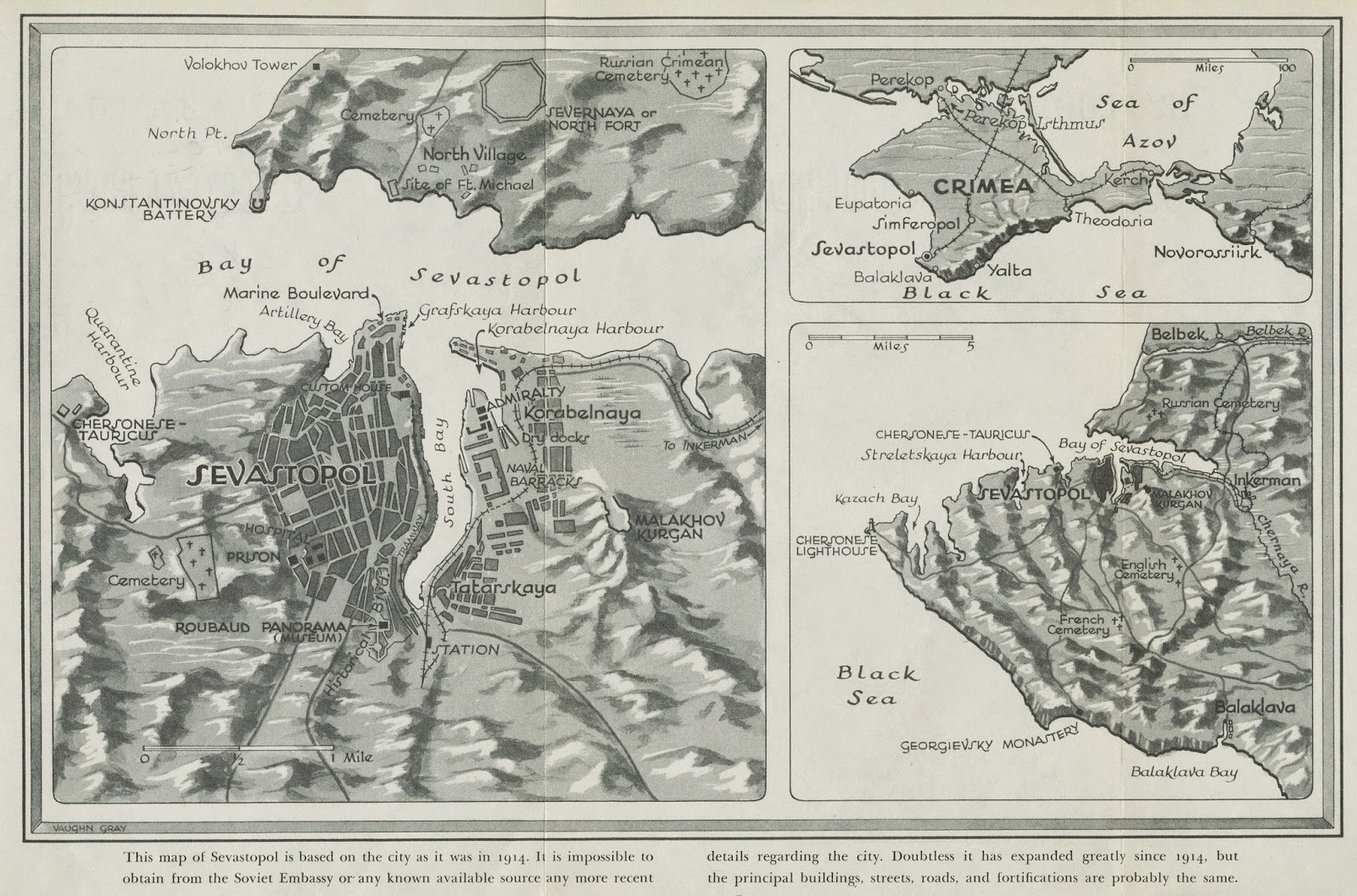
This map of Sevastopol, Crimea--formerly of the Ukraine--was published in the book, Last Days of Sevastopol by Boris Voyetekhov in 1943. The map notes, "This map of Sevastopol is based on the city as it was in 1914. It is impossible to obtain from the Soviet Embassy or any known available source any more recent details regarding the city...."

April is Child Abuse Prevention Month. This map shows the rates of reported child abuse and child fatalities due to abuse and neglect. The map is from the Allyn Bacon Social Atlas of the United States available from the GRMC and the Atlas Collection in Bracken Library.
Maps from the GRMC circulate for two weeks or longer. Atlases circulate for 28 days or longer. For more information, please contact the GRMC at 765-285-1097.
1 comment:
Excellent map site!
Post a Comment