
Hitting the Road...and So Much More
The Atlas Collection
Many people are familiar with road atlases—they store one in their car or they purchase one to plan for a trip. The Atlas Collection located outside the Geospatial Center & Map Collection contains hundreds of road atlases for specific counties and cities from all over the world, as well as road atlases of states and countries, and even continents.
The Atlas Collection includes road atlases for Australia, Kenya, Sri Lanka, Poland, Iran, and many other exotic locations around the world. Traveling to Iceland? There is a road atlas of the country in the Collection. Feel like hitting the road in Namibia? Yes, there is a road atlas for that country, too.
Tourists can find travel atlases, too, included in the Collection that can be used for their next vacation. Countries as diverse as Zimbabwe, Vietnam, Portugal, Turkey, Egypt, and Chile’ are included in popular travel atlases produced by Lonely Planet.
So atlases are a fantastic resource for travelers, but the Atlas Collection also includes atlases that can be used for the classroom and research covering various issues and disciplines. Atlases can prove to be an invaluable resource for both academic and personal use. The Atlas Collection contains over two thousand atlases, and nearly every country in the world is included. And many atlases focus on one singular issue, so the very specific maps included can be used in papers or presentations, and the maps can be easily scanned since they are more compact.
- History students or historians may be interested to know there are more than just general historical atlases in the Atlas Collection. The Illustrated Atlas of Native American History, Month-by-Month Atlas of World War II, Atlas of African American History and Politics, and The Atlas of the Sioux Wars are available from the Collection.
- Nursing students or others interested in health may find value in The State of Health Atlas, Atlas of Disease Distributions, or the Atlas of AIDS.
- Biology and Natural Resources students or environmentalists may find the following atlases useful: World Atlas of Desertification, Conservation Atlas of Tropical Forests, Atlas of Oceans, and Birds of North America.
- Politics is a popular topic of many atlases. Political Science students or others following politics may want to review The Atlas of Apartheid, State of China Atlas, or The Student Atlas of World Politics.
- Architects and urban planners would certainly be interested in the numerous atlases of specific cities and locations, but there are also some specific atlases that could be very useful as well. An Atlas of Rare City Maps: Comparative Urban Design, 1830-1842 and Bird's Eye Views: Historic Lithographs of North American Cities both offer historic perspectives of cities. New York: the Photo Atlas offers aerial photographs of all five boroughs of the city from 2004. And The Phaidon Atlas of Contemporary World Architecture (Travel Edition) is the first issue of this atlas available for circulation from the University Libraries.
- Educators often use atlases in the classroom to teach geography and other subjects, but there are also atlases about education available in the Atlas Collection. The Atlas of American Higher Education and Growing Up in America: An Atlas of Youth in the USA are atlases that document various issues of education in the United States.
- Anthropology, Archaeology, and Sociology students and faculty will find a plethora of topics from their classrooms covered in atlases: New Historical Atlas of Religion in America, Atlas of the Arab World, Student Atlas of Anthropology, The World Atlas of Archaeology, Atlas of World Cultures : a Geographical Guide to Ethnographic Literature, and State of Women in the World Atlas.
- Even English and literature students and faculty can find relative maps in some of the atlases in the Atlas Collection. There is an entire atlas dedicated to the works of J.R.R. Tolkien—The Atlas of Middle Earth. And The Atlas of Fantasy includes maps of fictional locations. This unique atlas includes a map of Gulliver’s travels, Hell as depicted by John Milton, the world of Sherlock Holmes from the books of Arthur Conan Doyle, and even a map of the “Hundred Acre Wood” included in the book Winnie-the-Pooh by A.A. Milne.
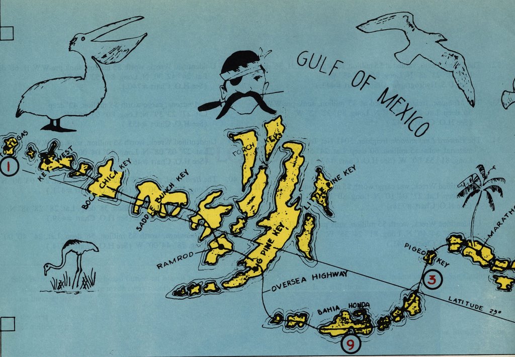
So atlases do not necessarily need to be used for serious academic purposes. The Atlas Collection also includes other atlases that are interesting and entertaining: Atlas of American Sport, USA Today Golf Atlas, Fish Michigan: 50 Rivers, and Freshwater Fishing and Hunting in Virginia cover recreational activities. The Atlas of Treasure Maps is an interesting collection of maps and nautical charts of sunken ships and shipwrecks (map shown above). And another great atlas to read for pleasure is The Traveler’s Atlas: A Global Guide to the Places You Must See in a Lifetime--the title speaks for itself.
Also, many of the atlases in the Atlas Collection have incorporated the use of GIS software and technology into the content. Several GIS-related books are included in the Atlas Collection: GIS and Crime Mapping, Exploring the Urban Community: A GIS Approach, and Think Globally, Act Regionally: GIS and Data Visualization for Social Science and Public Policy Research.
Check the University Libraries CardCat library catalog for other atlases found in other areas of the Library. Atlases like The Tobacco Atlas and The Historical Atlas of the Crusades, and many others can also be found inside the Geospatial Center & Map Collection, the Reference section, the Educational Resources Center, and the General Collection.
No comments:
Post a Comment