 November 2006 in the GCMC: What is GIS? Where is Congerville? and World War II
Students in Journalism 102 learned about what GIS is and how it is used in journalism and the media during a class presented by Angela Gibson from the Geospatial Center & Map Collection on November 13. Students in the Education Library 380/580 class learned about different types of maps and atlases, software, websites, and other resources during a class in the GCMC presented by Melissa Gentry on November 21. And Biology students learned about nautical charts in a special class project using maps from the GCMC.
Students from Industry and Technology: Construction Technology classes were provided digital aerial maps of campus for a class surveying project. A group of architecture students needed digital footprints of buildings in downtown Muncie. Another patron asked to view some of the aerial photgraphy of Indiana available in the GCMC to assess the implications of the proposed Indiana toll road in the local community.
Students from classes in geology, elementary education, geography travel and tourism, architecture, landscape architecture, historic preservation, communications, English, and music borrowed maps and atlases for various projects. One student was teaching elementary students about map projections, so she borrowed the Upside Down Map of the World to show a different perspective about making maps.
A World War II veteran used the services of the GCMC in November. The veteran was trying to find a map of the city of Reims in France, where he was stationed during the war. A copy of one of the maps was printed on the Center's large-format plotter. Another patron was planning an ambitious canoe trip and borrowed maps of Indiana rivers. And one researcher visited the Center trying to locate the village of Congerville in Delaware County--once the site of a professional football team, the Flyers.
Visit the GCMC Monday through Friday for GIS, maps, atlases, or to use the plotter printer. Contact the staff of the GCMC to schedule instructional sessions in the classroom or in the Center.
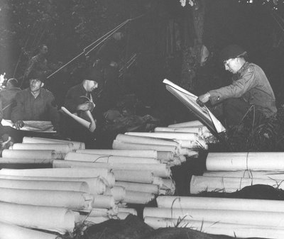
(The above photograph shows soldiers in World War II with a stockpile of maps. The photograph is from the Collection of Dennis Giangreco from the U.S. Army Atlas of the European Theater in World War II created by the U.S. Army Center of Military History and is available in the Atlas Collection of Bracken Library).

No comments:
Post a Comment