Friday, October 27, 2006

Ball State University Fall Break Plans


Take a Break with Maps

Ball State University's Fall Break begins this weekend and continues through Tuesday, October 31. Students wondering what to do with all of this freetime may want to consider a trip to Indianapolis. The Children's Museum of Indianapolis is sponsoring an exhibit in conjunction with the National Geographic Society. The exhibit, National Geographic MAPS: Tools for Adventure, is interactive and appeals to explorers of all ages, introducing people to the adventure and excitement of maps.

Visitors will engage in hands-on activities using basic map skills and different types of maps to find the way and to solve problems. The exhibit features activities based on the travels of explorers of the past like Lewis and Clark, Amelia Earhart, and the ancient Chinese mariner Zheng He. Visitors will also learn about and complete activities related to present-day explorers: Zahi Hawass used a robot to map the Great Pyramids; Phil Masters mapped the ocean to discover Blackbeard's pirate ship; biologist Michael Fay mapped locations of animals and plants in the Congo River basin in order to protect habitats.

The Children's Museum of Indianapolis is open Tuesday through Sunday from 10:00 A.M. to 5:00 P.M., so don't plan a Monday visit.

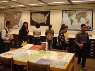
The Geospatial Center & Map Collection will be open during Fall Break with regular hours 8:00 A.M. to 5:00 P.M. Monday through Friday.

Wednesday, October 25, 2006

GCMC Election Resources


2006 Election Campaign Guide: Geospatial Center & Map Collection Election Selections

Election Day is November 7, 2006, and maps are an ideal tool for illustrating various information and statistics about elections. The widely-used "blue states and red states" explanation of states' party affiliations has become a cultural phrase and was made popular from an election map from the 2000 Presidential election.

The Geospatial Center & Map Collection houses many maps and atlases about elections--both current and historical. Maps depicting newly-drawn Congressional districts, presidential election results since 1789, and even local city council districts are available in the Center. U.S. Census data is also available in the Center.

The Atlas Collection also provides excellent election resources. The Routledge Historical Atlas of Presidential Elections, The Historical Atlas of State Power in Congress, and The Historical Atlas of Political Parties in the United States Congress are very current and thorough sources of information. Atlas of American Politics 1960-2000 features several maps about elections: Voter Turnout; Democratic Campaign Stops, 2000; Republican Campaign Stops, 2000; Party Affiliation in the House of Representatives (shown above). But the atlas also contains more specific political maps: Senate Vote to Convict or Acquit President Clinton on Impeachment; Cabinet Secretaries' Home States; Supreme Court Justice Confirmation Votes; Women in State Legislatures. And this atlas also features maps describing general information indirectly related to elections: Per Capita Hazardous Waste Generation; Methods of Capital Punishment in Each State; Violent Crime Rate; Teacher Salaries; Abortion Rates; Firearm Injury Death Rate.

The Internet can also be an excellent resource for timely information about the elections:

Contact the staff of the GCMC for more information about these and other election resources. (The Atlas Collection even includes a rare atlas covering the first elections in Kosovo and elections in P0land). Check out the election maps on display in the front windows of the Center. Voters should find the above resources informative and helpful in making their election selections.


Wednesday, October 18, 2006

News from the Australia Center

Postcard from Australia

The Geospatial Center & Map Collection purchased a set of topographic maps and aerial photography from the Land Office of New South Wales in Australia for the area around the Ball State University Australia Center in Lennox Head. Students studying in Australia this semester will be using the maps for various classroom activities and field work. The Director of the Australia Center, Paul Wohlt, sent this photograph with news from the Center. The photograph shows the Grosse Valley and Blue Mountains just north of Katoomba, Australia. Katoomba is a city in the eastern part of New South Wales that is known for its tourist resorts and orchards.

Please contact the GCMC for information about using maps in the classroom. The GCMC often accepts requests for maps to be added to the Collection.

Thursday, October 12, 2006

Online Resources

Surfing in the GCMC

Searching for map and GIS resources on the Internet can be a time consuming and even inefficient pursuit. Surfers could spend hours reviewing all of the websites offering maps and GIS data. And which sites actually provide accurate information? Staff in the GCMC can assist with this activity by providing information about reliable online geographic websites. Some of the following sites can be an excellent place to begin searching and surfing both for academic and amusement purposes:

Web-logs or Blogs can also be an excellent resource for current geographic news and information:

Please visit the GCMC for more information about online resources for maps, atlases, and GIS information. More information can be found on the GCMC website under Online Maps at www.bsu.edu/library/collections/gcmc/

Wednesday, October 11, 2006

International Festival Display


GCMC Maps Part of International Festival Display

The Rinker Center for International Programs sponsored the International Festival on Friday, October 6, in the Student Center Cardinal Hall. The International Festival, or I-Fest, is an educational and entertaining event featuring cultural displays from 85 different countries.

The Latin America booth at the I-Fest featured maps borrowed from the Geospatial Center & Map Collection as part of their display. Staff from the GCMC assisted Jacqueline Hanoman and Lucia Martinez selecting the various maps used for the display. A variety of maps were chosen to decorate the booth and provide information about Latin American countries, the archaeology of Central and South America, history, legends and cultural features.

The booth also featured PowerPoint presentations on Brazil, Colombia, Nicaragua, Ecuador, and Venezuela. Visitors to the booth also enjoyed some traditional music and food from Latin America. Latin American students were also available at the booth to teach about their countries and native cultures. Jacqueline Hanoman said that the idea of the booth was "to emphasize the unity of the Latin American nations" but also to "distinguish the diversity of the nations." Hanoman said that using maps to decorate their display really "made the difference," and she said that she will definitely use more maps again for other presentations. The GCMC was very honored to provide maps for such a beautiful display (photgraphed above).

Please contact the GCMC if you would like to borrow maps for a presentation or display. The staff of the GCMC would be happy to help choose maps and will even encapsulate maps for a more convenient display option.

History of the GCMC


Destination Memory Lane: History of the Geospatial Center & Map Collection

In recent years the size of the collection has expanded, and the services provided by the Geospatial Center & Map Collection have multiplied--augmented by the GIS resources available in the GIS lab. But this is not the first time in the history of the GCMC that expansion has been so dramatic.

The original Map Collection space in Bracken Library when the library opened was located in BL 218--now the Dean's office. Government Publications was housed in the current GCMC location. The photograph above shows how the GCMC space looked when it was occupied by Government Publications. (Photograph courtesy of Ball State University Archives & Special Collections Research Center).

A consultant from the Library of Congress actually determined the space specifications for the Map Collection in 1971. The consultant, Frazier Poole, designed a space for housing 50,000 maps and office space in BL 218. However, in the early Map Collection space, there was not an adequate area for patrons to actually research and review the maps or for staff to process and repair maps. Paul Stout, Assistant Professor Emeritus Library Services and retired Map Librarian, said that the space was limited. "We were so crowded that we stored maps in locked cases outside the Map Collection along the east wall of BL 218." Also atlases were not located near the Map Collection as they are today, so sometimes patrons had to travel all over the Library for resources.

Finally in the summer of 1993, the burgeoning Map Collection was moved to its current location in BL 224--doubling its available space. This was important because the collection itself had more than doubled in size. Government Publications was moved to its current location near the Reference area, and atlases were transferred to become part of an "annex" to the Map Collection, which provided more convenient use for patrons.

The most recent expansion of the GCMC occurred ten years later in the summer of 2003. A GIS lab with eight high-end computers was installed to provide services for patrons using GIS software for their research and educational needs. The GIS Specialist was added to the staff in the fall to provide assistance with GIS projects. And now both the maps and atlases in the collection have mushroomed to include over 140,000 maps and nearly 3,000 atlases.

Visitors are welcome to take a trip down memory lane in the Geospatial Center & Map Collection in its current location on the second floor of Bracken Library...or at least find a map of Memory Lane in the collection.

Tuesday, October 03, 2006

Map Showing Peak Times for Fall Color


FYI: Important Map for the Fall

The Weather Channel website is obviously a popular site for checking local weather conditions. But the site also includes some informative maps. This map shows the normal peak times for viewing the fall foliage in different areas around the country. Other maps offer information about allergies, flu outbreaks, skin protection, and other health and safety issues. Still other maps provide information about outdoor activities such as golf, skiing, or going to the beach. Even seasonal maps for wedding planning are available. The website is located at http://www.weather.com/maps/garden.html

Visitors to the GCMC from China


Visitors from Around the World

The Geospatial Center & Map Collection hosted a group visiting Ball State University from Deyang, China on September 27. The group of city government workers will be visiting Ball State for two months to experience the culture and participate in managerial training through an exchange program.

The visitors were thrilled to see so many maps of their hometown Deyang and the Sichuan Province included in the Map Collection here at Bracken Library. Many of the maps and atlases from the Collection were produced in Chinese. The Collection also includes topographic maps that show the specific terrain around the area of Deyang.

Ming-Ming Kuo, Collection Development Librarian, sponsored the tour of the University Libraries through the Office of Organizational Resources and the Center for International Programs.

Special October Map Display


Special October Map Display:

GHOSTS IN THE GCMC!

GCMC student-assistant Casey Gentis created a special map for a spooky October display. Casey researched legends of haunted locations in Indiana and created a map of some of the locations.

Interestingly, most Indiana campuses are haunted. Casey discovered stories about haunted locations at Purdue University, the University of Notre Dame, Indiana University, Valparaiso University, St. Joseph's College, Huntington College, the University of St. Francis, Earlham College, Franklin College, Hanover College, and Ball State University. There also seems to be a prevalence of haunted libraries.

Check out the scary map Indiana's Haunted Hometowns...Allegedly in the window of the GCMC on the second floor of Bracken Library.


September 2006 Map Displays


In the Window: September 2006 GCMC Map Displays

The "Map of the Month" for September 2006 was this World Terrorism Reference Map. This map was chosen to mark the fifth anniversary of the September 11th tragedies. The map features terrorist incidents that have occurred all over the world from 1967 to 2002. The map is available from the GCMC. Maps circulate for two weeks but may be renewed.

September 2006 GCMC Events


What's Happening in the GCMC?
September 2006 Edition

The Geospatial Center & Map Collection hosted four sessions of two workshops during September. Introduction fo GIS and Map Resources was presented on September 6 and 19. Participants learned about the variety of resources available digitally, online, using GIS software, and provided from thousands of maps and atlases in the GCMC. GIS Data Workshop took place on September 7 and 20, and participants in this class learned about the best, most reliable GIS resources available. Participants were able to get hands-on experience with GIS software and other resources.

The GCMC also welcomed many "tourists" to the area in September. Over 130 people toured the GCMC. English and Honors College classes learned about how to use maps, atlases, and GIS data as visual aids in papers and presentations. A tour group from Deyang, China, viewed maps of their city and country. And two classes from an Indianapolis school learned about the GCMC as part of their visit to Ball State encouraging them to try to attend college some day.

The GIS Specialist began working on research projects in connection with students and faculty from the Departments of Psychology, Journalism, Urban Planning, Landscape Architecture, and the Supported Employment Consultation and Training Center.

Several maps were borrowed from the GCMC in September for local presentations. A guest speaker at the Rotary Club borrowed maps of Israel, and another from the Fishers Institute of Wellness and Gerontology borrowed maps of China.

Students and faculty from a number of disciplines used the GCMC's resources in September: landscape architecture, architecture, historic preservation, urban planning, elementary education, biology, GIS and cartography, geology, English, physics and astronomy, geography, construction management, and social studies methods.

The GCMC is open Monday through Friday from 8:00 A.M. to 5:00 P.M.